Area Overview for BN2 3HZ
Photos of BN2 3HZ
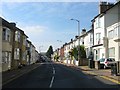
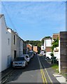
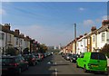
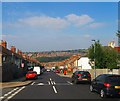
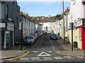
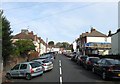
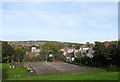
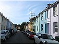
100 photos from this area
Area Information
Key information about the BN2 3HZ including its size, population, and administrative classification.
- Area Type
- Postcode
- Area Size
- 4678 m²
- Population
- 1960
- Population Density
- 20103 people/km²
House Prices in BN2 3HZ
34
Properties
£180,813
Average Sold Price
£57,000
Lowest Price
£355,000
Highest Price
Showing 34 properties
| Address | Type | Beds | Baths | Last Sale Price | Last Sale Date | |
|---|---|---|---|---|---|---|
| 75A Lewes Road, Brighton, BN2 3HZ | Maisonette | 2 | 1 | £315,000 | Mar 2022 | |
| 91A Lewes Road, Brighton, BN2 3HZ | Maisonette | 3 | 1 | £355,000 | Jan 2017 | |
| 83A Lewes Road, Brighton, BN2 3HZ | Flat | - | - | £175,000 | Apr 2016 | |
| 77A Lewes Road, Brighton, BN2 3HZ | Flat | 2 | 1 | £140,000 | Oct 2006 | |
| 74A Lewes Road, Brighton, BN2 3HZ | Terraced | 7 | 7 | £250,000 | Sep 2005 | |
| 72A Lewes Road, Brighton, BN2 3HZ | Flat | - | - | £57,000 | Jun 2002 | |
| 92B Lewes Road, Brighton, BN2 3HZ | Flat | - | - | £90,000 | Jun 2001 | |
| 73A Lewes Road, Brighton, BN2 3HZ | Maisonette | 1 | 1 | £64,500 | Mar 2000 | |
| 92A Lewes Road, Brighton, BN2 3HZ | Flat | - | - | - | - | |
| Flat 1, 63-65 Lewes Road, Brighton, BN2 3HZ | Flat | - | - | - | - |
Page 1 of 4
Energy Efficiency in BN2 3HZ
Amenities
Schools
| Rank | School | Type | Entry gender | Ages |
|---|
Explore more schools in this area
Go to Schools tabDemographics
Household Size
Family (3-5 people)
most common
Accommodation Type
Flats
most common
Tenure
34
majority
Ethnic Group
White
most common
Religion
N/A
most common
Household Composition
N/A
most common
Age
22
median
Young Adults (15-29 years)
most common
Household Deprivation
N/A
with no deprivation
NS-SEC
23
in Lower managerial occupations
Explore more demographic insights in this area
Go to Demographics tabPlanning
Planning Constraints
- Flood RiskPremium
- Ramsar Wetland SitesPremium
- Area of Outstanding Natural BeautyPremium
- Protected Nature ReservePremium
- Protected WoodlandPremium