Area Overview for BN2 0GG
Photos of BN2 0GG
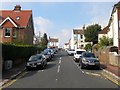
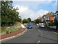
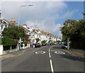
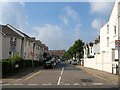
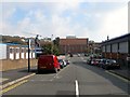
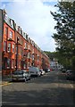
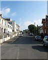
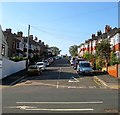
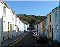
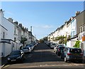
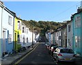
100 photos from this area
Area Information
Key information about the BN2 0GG including its size, population, and administrative classification.
- Area Type
- Postcode
- Area Size
- 8064 m²
- Population
- 1788
- Population Density
- 12699 people/km²
House Prices in BN2 0GG
88
Properties
£418,278
Average Sold Price
£54,950
Lowest Price
£925,000
Highest Price
Showing 88 properties
| Address | Type | Beds | Baths | Last Sale Price | Last Sale Date | |
|---|---|---|---|---|---|---|
| 116 Queens Park Road, Brighton, BN2 0GG | Terraced | 6 | 3 | £745,000 | Feb 2025 | |
| 158 Queens Park Road, Brighton, BN2 0GG | Terraced | 4 | 3 | £925,000 | Mar 2023 | |
| 128A Queens Park Road, Brighton, BN2 0GG | Flat | 1 | 1 | £311,000 | Dec 2022 | |
| 146A Queens Park Road, Brighton, BN2 0GG | Flat | - | - | £325,000 | Jun 2021 | |
| 166 Queens Park Road, Brighton, BN2 0GG | Terraced | 5 | 3 | £450,000 | Jun 2019 | |
| 100 Queens Park Road, Brighton, BN2 0GG | Terraced | 4 | 2 | £730,000 | Nov 2016 | |
| 114 Queens Park Road, Brighton, BN2 0GG | house | - | - | £825,000 | Aug 2016 | |
| 110 Queens Park Road, Brighton, BN2 0GG | house | 1 | 2 | £365,000 | Mar 2010 | |
| 152 Queens Park Road, Brighton, BN2 0GG | Semi-detached | - | - | £500,000 | Feb 2010 | |
| 172 Queens Park Road, Brighton, BN2 0GG | Detached | - | - | £347,000 | Oct 2006 |
Page 1 of 9
Energy Efficiency in BN2 0GG
Amenities
Schools
| Rank | School | Type | Entry gender | Ages |
|---|
Explore more schools in this area
Go to Schools tabDemographics
Household Size
Two person
most common
Accommodation Type
Houses
most common
Tenure
48
majority
Ethnic Group
White
most common
Religion
N/A
most common
Household Composition
N/A
most common
Age
47
median
Adults (30-64 years)
most common
Household Deprivation
N/A
with no deprivation
NS-SEC
40
in Lower managerial occupations
Explore more demographic insights in this area
Go to Demographics tabPlanning
Planning Constraints
- Flood RiskPremium
- Ramsar Wetland SitesPremium
- Area of Outstanding Natural BeautyPremium
- Protected Nature ReservePremium
- Protected WoodlandPremium