Area Overview for BN2 0ED
Photos of BN2 0ED
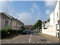
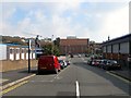
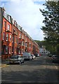
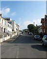
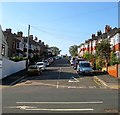
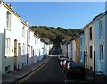
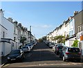
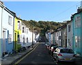
100 photos from this area
Area Information
Key information about the BN2 0ED including its size, population, and administrative classification.
- Area Type
- Postcode
- Area Size
- 1.0 hectares
- Population
- 1743
- Population Density
- 6523 people/km²
House Prices in BN2 0ED
51
Properties
£519,358
Average Sold Price
£141,800
Lowest Price
£810,000
Highest Price
Showing 51 properties
| Address | Type | Beds | Baths | Last Sale Price | Last Sale Date | |
|---|---|---|---|---|---|---|
| 38 Walpole Terrace, Brighton, BN2 0ED | Terraced | 4 | 1 | £573,000 | Apr 2025 | |
| 31 Walpole Terrace, Brighton, BN2 0ED | Terraced | 4 | 2 | £810,000 | Apr 2024 | |
| 30 Walpole Terrace, Brighton, BN2 0ED | house | 4 | 1 | £650,000 | Jun 2022 | |
| 17A Walpole Terrace, Brighton, BN2 0ED | Flat | - | - | £245,000 | Feb 2021 | |
| 27 Walpole Terrace, Brighton, BN2 0ED | house | 4 | - | £735,000 | Feb 2021 | |
| 25 Walpole Terrace, Brighton, BN2 0ED | Terraced | 3 | 2 | £710,000 | Jan 2018 | |
| 28 Walpole Terrace, Brighton, BN2 0ED | Terraced | 4 | 3 | £575,000 | Mar 2016 | |
| 19A Walpole Terrace, Brighton, BN2 0ED | Flat | - | - | £262,500 | Mar 2015 | |
| 18 Walpole Terrace, Brighton, BN2 0ED | house | - | - | £800,000 | Apr 2014 | |
| 26 Walpole Terrace, Brighton, BN2 0ED | house | 4 | - | £515,000 | Aug 2013 |
Page 1 of 6
Energy Efficiency in BN2 0ED
Amenities
Schools
| Rank | School | Type | Entry gender | Ages |
|---|
Explore more schools in this area
Go to Schools tabDemographics
Household Size
One person
most common
Accommodation Type
Flats
most common
Tenure
27
majority
Ethnic Group
White
most common
Religion
N/A
most common
Household Composition
N/A
most common
Age
47
median
Adults (30-64 years)
most common
Household Deprivation
N/A
with no deprivation
NS-SEC
35
in Lower managerial occupations
Explore more demographic insights in this area
Go to Demographics tabPlanning
Planning Constraints
- Flood RiskPremium
- Ramsar Wetland SitesPremium
- Area of Outstanding Natural BeautyPremium
- Protected Nature ReservePremium
- Protected WoodlandPremium