Area Overview for BN18 0ZY
Photos of BN18 0ZY
Area Information
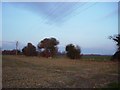
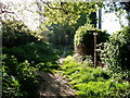
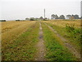
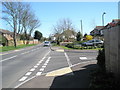
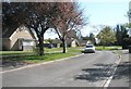
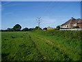
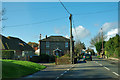
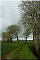
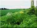
BN18 0ZY is a small, tightly knit postcode area in West Sussex, encompassing the village of Ford and its surrounding rural landscape. With a population of 2,260, it reflects a quiet, low-density settlement centred on the River Arun, historically linked to a medieval ford that once served as a key crossing point. The area’s character is defined by its rural charm, with fertile agricultural land and a mix of traditional homes and semi-rural infrastructure. Ford lies just 2 miles south of Arundel, offering proximity to larger towns while retaining its village identity. Daily life here is shaped by the local church, community-focused amenities, and a network of nearby railway stations. The area’s modest size means it is both intimate and practical, with residents benefiting from easy access to nearby towns and natural features like the River Arun. Its history as a former airfield site and its listed buildings, such as the Saxon-era Saint Andrew-by-the-Ford church, add layers of heritage to its modern appeal. For those seeking a peaceful, rural lifestyle with easy connectivity, BN18 0ZY offers a distinctive blend of tradition and accessibility.
- Area Type
- Postcode
- Area Size
- Not available
- Population
- Not available
- Population Density
- Not available
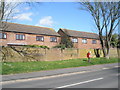
The property market in BN18 0ZY is dominated by owner-occupied homes, with 80% of properties owned by residents rather than rented. This high home ownership rate indicates a community of long-term residents and a stable housing market. The accommodation type is primarily houses, which is typical for rural areas where larger properties are more common than flats. This suggests that the area caters to families and individuals seeking space and privacy, rather than urban-style living. The small size of the postcode area means the housing stock is limited, but the focus on houses implies a mix of older, traditional homes and newer builds. For buyers, this could mean competition for available properties, though the rural setting may appeal to those prioritising tranquillity over proximity to city centres. The nearby Rudford Industrial Estate also hints at potential for mixed-use development, though the area remains predominantly residential.
House Prices in BN18 0ZY
No properties found in this postcode.
Energy Efficiency in BN18 0ZY
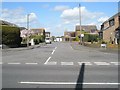
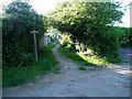
Living in BN18 0ZY offers a mix of rural tranquillity and practical amenities. Within practical reach are retail options such as Tesco Littlehampton, Tesco Barnham, and The Southern Co-operative Co, providing everyday shopping needs. The area’s railway stations—Ford, Barnham, and Littlehampton—offer easy access to nearby towns and transport links. The village itself features historic sites like the Grade I listed Saint Andrew-by-the-Ford church, a Saxon relic with Norman and Gothic elements, and the Ship and Anchor Public House, which dates back to 1640. These landmarks contribute to a sense of heritage and community. The River Arun and surrounding agricultural land provide natural spaces for leisure, while the Rudford Industrial Estate adds a semi-rural dimension. Daily life here balances tradition with convenience, offering both a peaceful environment and the necessary infrastructure for modern living.
Amenities
Schools
| Rank | School | Type | Entry gender | Ages |
|---|
Explore more schools in this area
Go to Schools tabDemographics
The population of BN18 0ZY is predominantly middle-aged, with a median age of 47 and the largest age group being adults aged 30–64. This suggests a community of established residents, many of whom may be in their prime working years or nearing retirement. Home ownership is high at 80%, indicating a stable, long-term demographic with a strong presence of family homes. The area is largely composed of houses rather than flats, reflecting its rural character and the preference for larger properties. The predominant ethnic group is White, with no specific data provided on other groups. The absence of detailed diversity statistics means the community’s cultural composition remains less defined in the data. The low median age and high home ownership rate suggest a focus on family living and long-term investment in property. This profile aligns with a quieter, less transient environment where residents are likely to have built careers and local ties over many years.
Household Size
Accommodation Type
Tenure
Ethnic Group
Religion
Household Composition
Age
Household Deprivation
NS-SEC
Explore more demographic insights in this area
Go to Demographics tabPlanning
Planning Constraints
- Flood RiskPremium
- Ramsar Wetland SitesPremium
- Area of Outstanding Natural BeautyPremium
- Protected Nature ReservePremium
- Protected WoodlandPremium