Area Overview for BN18 0BA
Photos of BN18 0BA
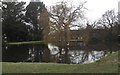
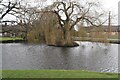
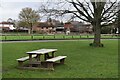
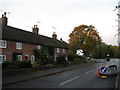


25 photos from this area
Area Information
Key information about the BN18 0BA including its size, population, and administrative classification.
- Area Type
- Postcode
- Area Size
- 40.5 hectares
- Population
- 1552
- Population Density
- 322 people/km²
House Prices in BN18 0BA
48
Properties
£385,122
Average Sold Price
£86,000
Lowest Price
£840,000
Highest Price
Showing 48 properties
| Address | Type | Beds | Baths | Last Sale Price | Last Sale Date | |
|---|---|---|---|---|---|---|
| Kelsey, Eastergate Lane, Walberton, BN18 0BA | house | 3 | - | £400,000 | Mar 2025 | |
| Mallards, Eastergate Lane, Walberton, BN18 0BA | house | - | - | £840,000 | Dec 2022 | |
| Mulberry Barn, Eastergate Lane, Walberton, BN18 0BA | Bungalow | 5 | 2 | £725,000 | Nov 2020 | |
| Dove Stone, Eastergate Lane, Walberton, BN18 0BA | house | - | - | £447,500 | Aug 2020 | |
| Fairfield, Eastergate Lane, Walberton, BN18 0BA | Bungalow | 4 | - | £800,000 | Sep 2017 | |
| Bluebell Cottage, Eastergate Lane, Walberton, BN18 0BA | Bungalow | 2 | - | £250,000 | Nov 2015 | |
| Oakdene, Eastergate Lane, Walberton, BN18 0BA | Semi-detached | - | - | £123,088 | Nov 2010 | |
| Eugenie, Eastergate Lane, Walberton, BN18 0BA | house | - | - | £250,000 | Mar 2010 | |
| The Farmhouse, Eastergate Lane, Walberton, BN18 0BA | Detached | - | - | £550,000 | Jun 2003 | |
| Cherry Tree Nursery, Eastergate Lane, Walberton, BN18 0BA | Land | - | - | £240,000 | Nov 2002 |
Page 1 of 5
Energy Efficiency in BN18 0BA
Amenities
Schools
| Rank | School | Type | Entry gender | Ages |
|---|
Explore more schools in this area
Go to Schools tabDemographics
Household Size
Two person
most common
Accommodation Type
Houses
most common
Tenure
82
majority
Ethnic Group
White
most common
Religion
N/A
most common
Household Composition
N/A
most common
Age
47
median
Adults (30-64 years)
most common
Household Deprivation
N/A
with no deprivation
NS-SEC
41
in Lower managerial occupations
Explore more demographic insights in this area
Go to Demographics tabPlanning
Planning Constraints
- Flood RiskPremium
- Ramsar Wetland SitesPremium
- Area of Outstanding Natural BeautyPremium
- Protected Nature ReservePremium
- Protected WoodlandPremium