Area Overview for BN17 6SB
Photos of BN17 6SB
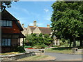
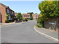
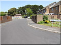
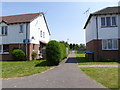
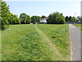
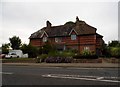
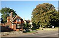
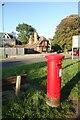
29 photos from this area
Area Information
Key information about the BN17 6SB including its size, population, and administrative classification.
- Area Type
- Postcode
- Area Size
- 6755 m²
- Population
- Not available
- Population Density
- Not available
House Prices in BN17 6SB
22
Properties
£244,517
Average Sold Price
£106,000
Lowest Price
£415,000
Highest Price
Showing 22 properties
| Address | Type | Beds | Baths | Last Sale Price | Last Sale Date | |
|---|---|---|---|---|---|---|
| 24 The Faroes, Littlehampton, BN17 6SB | Detached | 4 | 2 | £415,000 | Jul 2025 | |
| 40 The Faroes, Littlehampton, BN17 6SB | Terraced | 1 | 1 | £210,000 | Feb 2025 | |
| 36 The Faroes, Littlehampton, BN17 6SB | Terraced | 2 | 1 | £258,300 | Jan 2024 | |
| 34 The Faroes, Littlehampton, BN17 6SB | Terraced | 2 | 1 | £305,000 | Dec 2022 | |
| 26 The Faroes, Littlehampton, BN17 6SB | Detached | 3 | 1 | £325,000 | Aug 2020 | |
| 32 The Faroes, Littlehampton, BN17 6SB | Terraced | 2 | 1 | £232,000 | May 2019 | |
| 28 The Faroes, Littlehampton, BN17 6SB | Detached | 3 | 1 | £330,000 | Feb 2019 | |
| 30 The Faroes, Littlehampton, BN17 6SB | Detached | 4 | 2 | £395,000 | Oct 2018 | |
| 12 The Faroes, Littlehampton, BN17 6SB | house | - | - | £217,500 | Dec 2012 | |
| 38 The Faroes, Littlehampton, BN17 6SB | Terraced | - | - | £146,000 | Dec 2012 |
Page 1 of 3
Energy Efficiency in BN17 6SB
Amenities
Schools
| Rank | School | Type | Entry gender | Ages |
|---|
Explore more schools in this area
Go to Schools tabDemographics
Household Size
Family (3-5 people)
most common
Accommodation Type
Houses
most common
Tenure
72
majority
Ethnic Group
White
most common
Religion
N/A
most common
Household Composition
N/A
most common
Age
47
median
Adults (30-64 years)
most common
Household Deprivation
N/A
with no deprivation
NS-SEC
29
in Lower managerial occupations
Explore more demographic insights in this area
Go to Demographics tabPlanning
Planning Constraints
- Flood RiskPremium
- Ramsar Wetland SitesPremium
- Area of Outstanding Natural BeautyPremium
- Protected Nature ReservePremium
- Protected WoodlandPremium