Area Overview for BN17 5AX
Photos of BN17 5AX
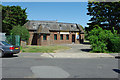
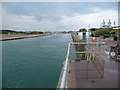

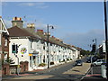
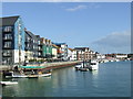
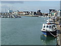
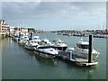
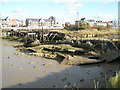
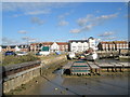
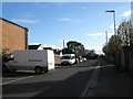
106 photos from this area
Area Information
Key information about the BN17 5AX including its size, population, and administrative classification.
- Area Type
- Postcode
- Area Size
- 9322 m²
- Population
- 2507
- Population Density
- 1689 people/km²
House Prices in BN17 5AX
31
Properties
£170,734
Average Sold Price
£24,500
Lowest Price
£375,000
Highest Price
Showing 31 properties
| Address | Type | Beds | Baths | Last Sale Price | Last Sale Date | |
|---|---|---|---|---|---|---|
| 17 New Road, Littlehampton, BN17 5AX | Terraced | 3 | 1 | £250,000 | Oct 2023 | |
| 11A New Road, Littlehampton, BN17 5AX | Terraced | 2 | 1 | £250,000 | Oct 2022 | |
| Katella Cottage, New Road, Littlehampton, BN17 5AX | Retail | 2 | 1 | £265,500 | Aug 2022 | |
| 18 New Road, Littlehampton, BN17 5AX | Terraced | 3 | 2 | £375,000 | Feb 2021 | |
| 21 New Road, Littlehampton, BN17 5AX | Terraced | 2 | - | £164,000 | Dec 2020 | |
| 1 New Road, Littlehampton, BN17 5AX | Terraced | 3 | 1 | £185,000 | Nov 2018 | |
| 23 New Road, Littlehampton, BN17 5AX | Terraced | 3 | 1 | £198,000 | Nov 2017 | |
| 11 New Road, Littlehampton, BN17 5AX | Terraced | 3 | 1 | £180,000 | Jul 2015 | |
| 22 New Road, Littlehampton, BN17 5AX | house | 3 | - | £196,650 | Mar 2014 | |
| 28 New Road, Littlehampton, BN17 5AX | Terraced | - | - | £102,500 | Jul 2009 |
Page 1 of 4
Energy Efficiency in BN17 5AX
Amenities
Schools
| Rank | School | Type | Entry gender | Ages |
|---|
Explore more schools in this area
Go to Schools tabDemographics
Household Size
One person
most common
Accommodation Type
Flats
most common
Tenure
37
majority
Ethnic Group
White
most common
Religion
N/A
most common
Household Composition
N/A
most common
Age
47
median
Adults (30-64 years)
most common
Household Deprivation
N/A
with no deprivation
NS-SEC
22
in Lower managerial occupations
Explore more demographic insights in this area
Go to Demographics tabPlanning
Planning Constraints
- Flood RiskPremium
- Ramsar Wetland SitesPremium
- Area of Outstanding Natural BeautyPremium
- Protected Nature ReservePremium
- Protected WoodlandPremium