Area Overview for BN16 4QS
Photos of BN16 4QS
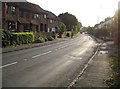
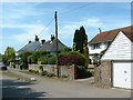
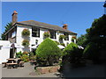
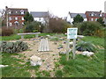
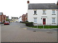
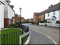
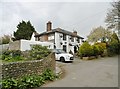
42 photos from this area
Area Information
Key information about the BN16 4QS including its size, population, and administrative classification.
- Area Type
- Postcode
- Area Size
- 2.2 hectares
- Population
- 2176
- Population Density
- 1186 people/km²
House Prices in BN16 4QS
27
Properties
£609,626
Average Sold Price
£413,495
Lowest Price
£709,995
Highest Price
Showing 27 properties
| Address | Type | Beds | Baths | Last Sale Price | Last Sale Date | |
|---|---|---|---|---|---|---|
| 18 The Groves, Angmering, BN16 4QS | house | - | - | £645,996 | Mar 2024 | |
| 19 The Groves, Angmering, BN16 4QS | house | - | - | £603,246 | Feb 2024 | |
| 26 The Groves, Angmering, BN16 4QS | house | - | - | £413,495 | Jan 2024 | |
| 20 The Groves, Angmering, BN16 4QS | house | - | - | £598,496 | Jan 2024 | |
| 9 The Groves, Angmering, BN16 4QS | house | - | - | £579,496 | Dec 2023 | |
| 6 The Groves, Angmering, BN16 4QS | house | - | - | £666,395 | Dec 2023 | |
| 24 The Groves, Angmering, BN16 4QS | house | - | - | £429,995 | Dec 2023 | |
| 30 The Groves, Angmering, BN16 4QS | house | - | - | £684,995 | Nov 2023 | |
| 23 The Groves, Angmering, BN16 4QS | house | - | - | £684,995 | Nov 2023 | |
| November House, 25 The Groves, Angmering, BN16 4QS | Detached | - | - | £629,995 | Nov 2023 |
Page 1 of 3
Energy Efficiency in BN16 4QS
Amenities
Schools
| Rank | School | Type | Entry gender | Ages |
|---|
Explore more schools in this area
Go to Schools tabDemographics
Household Size
Family (3-5 people)
most common
Accommodation Type
Houses
most common
Tenure
77
majority
Ethnic Group
White
most common
Religion
N/A
most common
Household Composition
N/A
most common
Age
47
median
Adults (30-64 years)
most common
Household Deprivation
N/A
with no deprivation
NS-SEC
43
in Lower managerial occupations
Explore more demographic insights in this area
Go to Demographics tabPlanning
Planning Constraints
- Flood RiskPremium
- Ramsar Wetland SitesPremium
- Area of Outstanding Natural BeautyPremium
- Protected Nature ReservePremium
- Protected WoodlandPremium