Area Overview for BN16 4AP
Photos of BN16 4AP


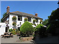
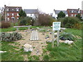
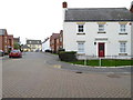
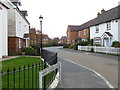
42 photos from this area
Area Information
Key information about the BN16 4AP including its size, population, and administrative classification.
- Area Type
- Postcode
- Area Size
- 4325 m²
- Population
- 2176
- Population Density
- 1186 people/km²
House Prices in BN16 4AP
16
Properties
£427,786
Average Sold Price
£272,500
Lowest Price
£860,000
Highest Price
Showing 16 properties
| Address | Type | Beds | Baths | Last Sale Price | Last Sale Date | |
|---|---|---|---|---|---|---|
| Turners Cottage, Roundstone Lane, Angmering, BN16 4AP | Semi-detached | 4 | 3 | £440,000 | Jun 2025 | |
| Belmont, Roundstone Lane, Angmering, BN16 4AP | Terraced | 3 | 1 | £398,000 | Jul 2022 | |
| Flint Cottage, Roundstone Lane, Angmering, BN16 4AP | Detached | 4 | 3 | £860,000 | Oct 2021 | |
| The Birches, Roundstone Lane, Angmering, BN16 4AP | Detached | 3 | 1 | £419,000 | Sep 2020 | |
| Dane Villa, Roundstone Lane, Angmering, BN16 4AP | house | - | - | £295,000 | Jun 2015 | |
| The Willows, Roundstone Lane, Angmering, BN16 4AP | Semi-detached | 4 | 2 | £310,000 | May 2015 | |
| Poundville, Roundstone Lane, Angmering, BN16 4AP | house | - | - | £272,500 | Aug 2010 | |
| Flat 4, Dane Acre, Roundstone Lane, Angmering, BN16 4AP | Flat | 2 | 2 | - | - | |
| Flat 7, Dane Acre, Roundstone Lane, Angmering, BN16 4AP | Flat | 2 | 2 | - | - | |
| Flat 3, Dane Acre, Roundstone Lane, Angmering, BN16 4AP | Flat | 2 | 2 | - | - |
Page 1 of 2
Energy Efficiency in BN16 4AP
Amenities
Schools
| Rank | School | Type | Entry gender | Ages |
|---|
Explore more schools in this area
Go to Schools tabDemographics
Household Size
Family (3-5 people)
most common
Accommodation Type
Houses
most common
Tenure
77
majority
Ethnic Group
White
most common
Religion
N/A
most common
Household Composition
N/A
most common
Age
47
median
Adults (30-64 years)
most common
Household Deprivation
N/A
with no deprivation
NS-SEC
43
in Lower managerial occupations
Explore more demographic insights in this area
Go to Demographics tabPlanning
Planning Constraints
- Flood RiskPremium
- Ramsar Wetland SitesPremium
- Area of Outstanding Natural BeautyPremium
- Protected Nature ReservePremium
- Protected WoodlandPremium