Area Overview for BN16 3SE
Photos of BN16 3SE
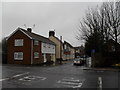
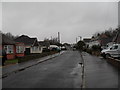
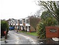
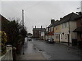
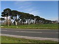
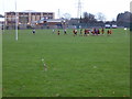
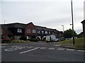

28 photos from this area
Area Information
Key information about the BN16 3SE including its size, population, and administrative classification.
- Area Type
- Postcode
- Area Size
- 1.9 hectares
- Population
- Not available
- Population Density
- Not available
House Prices in BN16 3SE
58
Properties
£228,108
Average Sold Price
£91,500
Lowest Price
£385,000
Highest Price
Showing 58 properties
| Address | Type | Beds | Baths | Last Sale Price | Last Sale Date | |
|---|---|---|---|---|---|---|
| 60 The Leas, Rustington, BN16 3SE | Terraced | 4 | 2 | £385,000 | May 2025 | |
| 23 The Leas, Rustington, BN16 3SE | Terraced | 2 | 2 | £285,000 | Mar 2025 | |
| 63 The Leas, Rustington, BN16 3SE | Terraced | 3 | 2 | £335,000 | Feb 2025 | |
| 12 The Leas, Rustington, BN16 3SE | Flat | 2 | 1 | £175,000 | Dec 2024 | |
| 24 The Leas, Rustington, BN16 3SE | house | 2 | - | £259,000 | Nov 2024 | |
| 4 The Leas, Rustington, BN16 3SE | Flat | 2 | - | £245,000 | Apr 2024 | |
| 33 The Leas, Rustington, BN16 3SE | Semi-detached | 2 | 2 | £260,000 | Oct 2023 | |
| 6 The Leas, Rustington, BN16 3SE | Flat | - | - | £255,000 | Sep 2023 | |
| 52 The Leas, Rustington, BN16 3SE | Terraced | 3 | 2 | £346,000 | Jul 2023 | |
| 21 The Leas, Rustington, BN16 3SE | Flat | 2 | - | £195,000 | Jul 2023 |
Page 1 of 6
Energy Efficiency in BN16 3SE
Amenities
Schools
| Rank | School | Type | Entry gender | Ages |
|---|
Explore more schools in this area
Go to Schools tabDemographics
Household Size
One person
most common
Accommodation Type
Houses
most common
Tenure
57
majority
Ethnic Group
White
most common
Religion
N/A
most common
Household Composition
N/A
most common
Age
47
median
Adults (30-64 years)
most common
Household Deprivation
N/A
with no deprivation
NS-SEC
26
in Lower managerial occupations
Explore more demographic insights in this area
Go to Demographics tabPlanning
Planning Constraints
- Flood RiskPremium
- Ramsar Wetland SitesPremium
- Area of Outstanding Natural BeautyPremium
- Protected Nature ReservePremium
- Protected WoodlandPremium