Area Overview for BN16 2JG
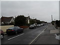
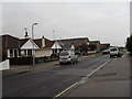
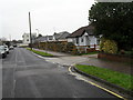
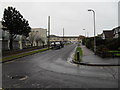
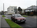
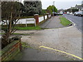
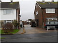
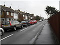
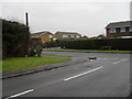
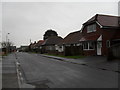
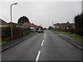
Photos of BN16 2JG

Area Information
BN16 2JG is a small, densely populated residential postcode in the village of Rustington, West Sussex. Covering just 1.1 hectares, it is a compact area with a population of 1724, translating to a population density of 153,673 people per square kilometre. This reflects a tightly knit community, typical of the village’s historic character. Rustington itself is a coastal village with roots stretching back to the Stone Age, yet it has evolved into a modern residential hub. The area’s mix of historic flint cottages and mid-20th-century housing developments creates a unique blend of old and new. With 81% of homes owner-occupied, the community is stable, though the median age of 70 suggests a predominantly elderly population. Daily life here is shaped by proximity to retail amenities like Waitrose Rustington and local railway stations, offering both convenience and connection to broader networks. The area’s charm lies in its quiet, suburban feel, balanced by the practicality of nearby services and transport links. For buyers, BN16 2JG represents a compact, well-served postcode with a distinct demographic profile.
- Area Type
- Postcode
- Area Size
- 1.1 hectares
- Population
- Not available
- Population Density
- Not available
The property market in BN16 2JG is defined by high home ownership (81%) and a dominance of flats. This suggests a mature market with limited rental activity, as most properties are owner-occupied. The prevalence of flats indicates a mix of older, purpose-built housing and post-war developments, which may appeal to those seeking compact, low-maintenance homes. Given the area’s small size (1.1 hectares) and high density, the housing stock is unlikely to expand significantly. Buyers should consider that the market is not geared toward family homes or larger properties, as the demographic skew toward elderly residents means demand for such properties is low. Proximity to retail and transport links, including nearby railway stations, adds to the area’s practicality. However, the limited availability of new builds or larger homes means buyers must focus on the existing stock, which may include older units requiring modernisation. The compact nature of BN16 2JG also means competition for properties is likely to be strong, particularly for those prioritising convenience over size.
House Prices in BN16 2JG
Showing 1 properties
| Address | Type | Beds | Baths | Last Sale Price | Last Sale Date | |
|---|---|---|---|---|---|---|
| Blind Veterans Uk, Princess Marina House, 57-59 Seafield Road, Rustington, BN16 2JG | house | - | - | £8,000,000 | Dec 2021 |
Energy Efficiency in BN16 2JG
Living in BN16 2JG offers access to a range of local amenities within practical reach. Retail options include Waitrose Rustington, Tesco Rustington, and Iceland Rustington, providing convenience for grocery shopping. The nearby railway stations—Angmering, Littlehampton, and Goring—offer easy access to regional transport networks, supporting both commuting and leisure travel. The village of Rustington itself blends historic charm with modern facilities, including 17th- and 18th-century flint cottages and newer developments. While the area lacks large parks or recreational spaces, its compact size means residents can walk to shops, cafes, and community hubs. The presence of trading estates and retail parades, such as Manor Retail Park, adds to the area’s practicality. For those seeking a quiet, suburban lifestyle with essential services nearby, BN16 2JG provides a balance of convenience and character. The mix of historic and contemporary features ensures a distinct identity, though the focus remains on local needs over expansive leisure options.
Amenities
Schools
| Rank | School | Type | Entry gender | Ages |
|---|
Explore more schools in this area
Go to Schools tabDemographics
BN16 2JG has a median age of 70, with the majority of residents aged 65 or older. This reflects a community shaped by long-term residency and limited new development. The area’s 81% home ownership rate indicates a stable population, with most properties occupied by owners rather than renters. Accommodation is predominantly flats, suggesting a mix of older housing stock and post-war developments. The predominant ethnic group is White, with no specific data on other demographics. The high proportion of elderly residents influences the area’s character, creating a quiet, low-traffic environment. However, this also means limited demand for family-oriented amenities. The population density of 153,673 people per square kilometre underscores the compact nature of the postcode, where every square metre is occupied. While this density supports local services, it also means the area is not suited for expanding households. For prospective buyers, understanding this demographic profile is key to assessing whether BN16 2JG aligns with their lifestyle needs.
Household Size
Accommodation Type
Tenure
Ethnic Group
Religion
Household Composition
Age
Household Deprivation
NS-SEC
Explore more demographic insights in this area
Go to Demographics tabPlanning
Planning Constraints
- Flood RiskPremium
- Ramsar Wetland SitesPremium
- Area of Outstanding Natural BeautyPremium
- Protected Nature ReservePremium
- Protected WoodlandPremium