Area Overview for BN15 9FF
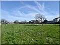
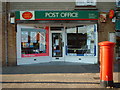
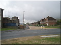
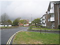
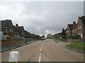
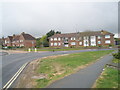
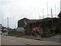
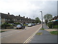
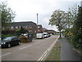
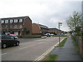
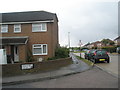
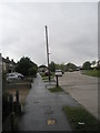
Photos of BN15 9FF
Area Information
Living in BN15 9FF means being part of a small, tightly knit residential cluster in Lancing, West Sussex. With a population of 1,375, this area blends historical charm with modern convenience. Lancing itself is a coastal village with Saxon roots, its name likely derived from “people of Wlanc,” reflecting centuries of settlement. The parish is defined by the River Adur to the east and the South Downs to the north, offering a mix of natural and cultivated landscapes. Daily life here is shaped by its suburban character, with a focus on family living and proximity to amenities. The area’s compact size means residents are within easy reach of shops, schools, and transport links, while the surrounding countryside provides a quieter backdrop. BN15 9FF is ideal for those seeking a balance between coastal living and suburban comfort, with a community rooted in tradition but connected to contemporary infrastructure.
- Area Type
- Postcode
- Area Size
- Not available
- Population
- Not available
- Population Density
- Not available
The property market in BN15 9FF is characterised by high home ownership (80%) and a focus on houses rather than flats or apartments. This suggests a predominantly owner-occupied area, with properties likely tailored to family needs. The scarcity of rental data implies limited availability of lettings, making the market more competitive for buyers. The small size of the postcode area means housing stock is limited, and proximity to amenities like schools and transport hubs may drive demand. For buyers, this presents both opportunities and challenges: properties are likely in good condition, but the area’s size means choices are constrained. Investors should consider the long-term stability of the market, supported by low crime rates and strong digital connectivity, which enhance the area’s appeal for both residential and professional use.
House Prices in BN15 9FF
No properties found in this postcode.
Energy Efficiency in BN15 9FF
The lifestyle in BN15 9FF is shaped by its proximity to retail, transport, and historical sites. Nearby shops include Co-op Lancing, Asda Lancing, and Budgens South, offering everyday essentials. The five railway stations provide easy access to urban centres, while two airports cater to travel needs. Historically, the area is linked to Lancing College, founded in 1848, and St James the Less Church, a Norman-style parish church. Though parks are not explicitly mentioned, the surrounding South Downs and River Adur suggest opportunities for outdoor activities. The mix of retail, transport, and heritage sites creates a convenient yet characterful environment, blending practicality with a sense of place.
Amenities
Schools
BN15 9FF is served by three independent schools: Ardmore School, Lancing Montessori Centre and Ardmore School, and Ardmore Montessori School. These institutions cater to families seeking private education, with a focus on alternative teaching methods at the Montessori centres. The presence of multiple independent schools suggests a demand for non-state education, possibly driven by the area’s middle-aged population and family-oriented demographics. While no Ofsted ratings are provided, the variety of school types indicates a range of educational philosophies available to residents. For families prioritising choice in schooling, this area offers access to private options, though the absence of state schools means reliance on nearby towns for public education.
| Rank | School | Type | Entry gender | Ages |
|---|
Explore more schools in this area
Go to Schools tabDemographics
BN15 9FF has a median age of 47, with the majority of residents falling into the 30-64 age range. This suggests a community skewed towards middle-aged adults, likely reflecting long-term residency and family-oriented living. Home ownership is high at 80%, indicating a stable, settled population. The accommodation type is predominantly houses, which aligns with the area’s suburban character and family-focused demographics. The predominant ethnic group is White, though no specific diversity statistics are provided. The absence of data on deprivation or income levels means the area’s economic profile remains less defined, but the high home ownership rate and age distribution imply a relatively affluent, mature community. This demographic profile supports a lifestyle prioritising stability, with residents likely valuing proximity to schools, green spaces, and local amenities.
Household Size
Accommodation Type
Tenure
Ethnic Group
Religion
Household Composition
Age
Household Deprivation
NS-SEC
Explore more demographic insights in this area
Go to Demographics tabPlanning
Planning Constraints
- Flood RiskPremium
- Ramsar Wetland SitesPremium
- Area of Outstanding Natural BeautyPremium
- Protected Nature ReservePremium
- Protected WoodlandPremium