Area Overview for BN15 9DF
Photos of BN15 9DF
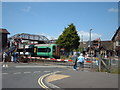
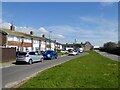
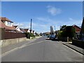
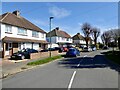
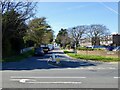
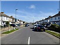
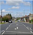
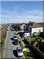
100 photos from this area
Area Information
Key information about the BN15 9DF including its size, population, and administrative classification.
- Area Type
- Postcode
- Area Size
- 1.6 hectares
- Population
- Not available
- Population Density
- Not available
House Prices in BN15 9DF
29
Properties
£258,350
Average Sold Price
£78,000
Lowest Price
£454,000
Highest Price
Showing 29 properties
| Address | Type | Beds | Baths | Last Sale Price | Last Sale Date | |
|---|---|---|---|---|---|---|
| 39 Barfield Park, Lancing, BN15 9DF | Bungalow | 3 | - | £410,000 | Sep 2025 | |
| 43 Barfield Park, Lancing, BN15 9DF | Bungalow | 3 | - | £440,000 | Sep 2022 | |
| 65 Barfield Park, Lancing, BN15 9DF | Bungalow | - | - | £454,000 | May 2022 | |
| 58 Barfield Park, Lancing, BN15 9DF | Bungalow | 2 | 1 | £392,000 | Dec 2021 | |
| 60 Barfield Park, Lancing, BN15 9DF | house | - | - | £345,000 | Sep 2020 | |
| 40 Barfield Park, Lancing, BN15 9DF | Bungalow | 3 | 2 | £410,000 | Oct 2019 | |
| 55 Barfield Park, Lancing, BN15 9DF | Bungalow | 2 | - | £285,000 | May 2017 | |
| 64 Barfield Park, Lancing, BN15 9DF | Bungalow | - | - | £290,000 | Sep 2015 | |
| 47 Barfield Park, Lancing, BN15 9DF | Bungalow | 3 | - | £267,500 | Aug 2015 | |
| 38 Barfield Park, Lancing, BN15 9DF | Bungalow | 3 | - | £260,000 | Apr 2015 |
Page 1 of 3
Energy Efficiency in BN15 9DF
Amenities
Schools
| Rank | School | Type | Entry gender | Ages |
|---|
Explore more schools in this area
Go to Schools tabDemographics
Household Size
Two person
most common
Accommodation Type
Houses
most common
Tenure
64
majority
Ethnic Group
White
most common
Religion
N/A
most common
Household Composition
N/A
most common
Age
47
median
Adults (30-64 years)
most common
Household Deprivation
N/A
with no deprivation
NS-SEC
26
in Lower managerial occupations
Explore more demographic insights in this area
Go to Demographics tabPlanning
Planning Constraints
- Flood RiskPremium
- Ramsar Wetland SitesPremium
- Area of Outstanding Natural BeautyPremium
- Protected Nature ReservePremium
- Protected WoodlandPremium