Area Overview for BN15 8RU
Photos of BN15 8RU
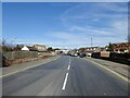
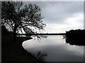
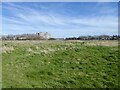
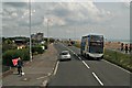
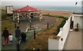
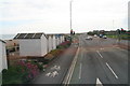
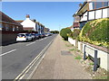
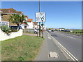
93 photos from this area
Area Information
Key information about the BN15 8RU including its size, population, and administrative classification.
- Area Type
- Postcode
- Area Size
- 1.7 hectares
- Population
- 1601
- Population Density
- 2935 people/km²
House Prices in BN15 8RU
25
Properties
£263,650
Average Sold Price
£79,950
Lowest Price
£390,000
Highest Price
Showing 25 properties
| Address | Type | Beds | Baths | Last Sale Price | Last Sale Date | |
|---|---|---|---|---|---|---|
| 3 Western Close, Lancing, BN15 8RU | Bungalow | - | - | £390,000 | Jan 2022 | |
| 18 Western Close, Lancing, BN15 8RU | Bungalow | 2 | - | £380,000 | Mar 2021 | |
| 26 Western Close, Lancing, BN15 8RU | Bungalow | 3 | 1 | £340,000 | Dec 2020 | |
| 25 Western Close, Lancing, BN15 8RU | Semi-detached | 3 | 2 | £375,000 | Apr 2017 | |
| 13 Western Close, Lancing, BN15 8RU | Semi-detached | 3 | - | £345,000 | Jun 2016 | |
| Eastgate House, 17 Western Close, Lancing, BN15 8RU | Bungalow | 4 | 3 | £340,000 | May 2011 | |
| Swakeleys, Western Close, Lancing, BN15 8RU | Detached | - | - | £263,000 | Jun 2008 | |
| 16 Western Close, Lancing, BN15 8RU | Bungalow | 2 | - | £220,000 | Jun 2007 | |
| 12 Western Close, Lancing, BN15 8RU | Bungalow | 3 | 1 | £242,000 | Nov 2006 | |
| 8 Western Close, Lancing, BN15 8RU | Detached | - | - | £275,000 | Nov 2006 |
Page 1 of 3
Energy Efficiency in BN15 8RU
Amenities
Schools
| Rank | School | Type | Entry gender | Ages |
|---|
Explore more schools in this area
Go to Schools tabDemographics
Household Size
Two person
most common
Accommodation Type
Houses
most common
Tenure
77
majority
Ethnic Group
White
most common
Religion
N/A
most common
Household Composition
N/A
most common
Age
47
median
Adults (30-64 years)
most common
Household Deprivation
N/A
with no deprivation
NS-SEC
30
in Lower managerial occupations
Explore more demographic insights in this area
Go to Demographics tabPlanning
Planning Constraints
- Flood RiskPremium
- Ramsar Wetland SitesPremium
- Area of Outstanding Natural BeautyPremium
- Protected Nature ReservePremium
- Protected WoodlandPremium