Area Overview for BN15 8RB
Photos of BN15 8RB
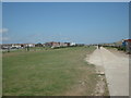
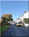
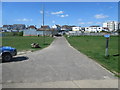
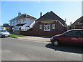
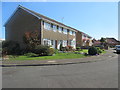
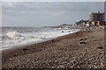
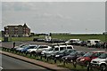
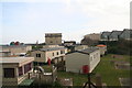
95 photos from this area
Area Information
Key information about the BN15 8RB including its size, population, and administrative classification.
- Area Type
- Postcode
- Area Size
- 1.6 hectares
- Population
- 1601
- Population Density
- 2935 people/km²
House Prices in BN15 8RB
16
Properties
£642,896
Average Sold Price
£137,000
Lowest Price
£2,500,000
Highest Price
Showing 16 properties
| Address | Type | Beds | Baths | Last Sale Price | Last Sale Date | |
|---|---|---|---|---|---|---|
| Former Mount Hermon Rest Home 85 To 87, Brighton Road, Lancing, BN15 8RB | Retirement | - | - | £2,500,000 | Jan 2022 | |
| Former 89, Brighton Road, Lancing, BN15 8RB | Detached | - | - | £2,500,000 | Jan 2022 | |
| 63 Brighton Road, Lancing, BN15 8RB | Detached | 5 | 2 | £536,000 | Sep 2021 | |
| 67 Brighton Road, Lancing, BN15 8RB | Semi-detached | 3 | 1 | £385,000 | Jan 2019 | |
| 75 Brighton Road, Lancing, BN15 8RB | Semi-detached | 3 | - | £260,000 | Dec 2013 | |
| Former 87A, Brighton Road, Lancing, BN15 8RB | Flat | - | - | £150,000 | Oct 2013 | |
| 77 Brighton Road, Lancing, BN15 8RB | Detached | 4 | 2 | £380,000 | May 2008 | |
| Sea Lodge, 73 Brighton Road, Lancing, BN15 8RB | Semi-detached | - | - | £243,000 | Feb 2008 | |
| 65 Brighton Road, Lancing, BN15 8RB | Detached | 2 | 1 | £192,500 | Apr 2006 | |
| Wheel Lodge, 81 Brighton Road, Lancing, BN15 8RB | Detached | 8 | 2 | £246,250 | Oct 2003 |
Page 1 of 2
Energy Efficiency in BN15 8RB
Amenities
Schools
| Rank | School | Type | Entry gender | Ages |
|---|
Explore more schools in this area
Go to Schools tabDemographics
Household Size
Two person
most common
Accommodation Type
Houses
most common
Tenure
77
majority
Ethnic Group
White
most common
Religion
N/A
most common
Household Composition
N/A
most common
Age
47
median
Adults (30-64 years)
most common
Household Deprivation
N/A
with no deprivation
NS-SEC
30
in Lower managerial occupations
Explore more demographic insights in this area
Go to Demographics tabPlanning
Planning Constraints
- Flood RiskPremium
- Ramsar Wetland SitesPremium
- Area of Outstanding Natural BeautyPremium
- Protected Nature ReservePremium
- Protected WoodlandPremium