Area Overview for BN15 8EG
Photos of BN15 8EG
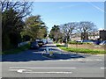
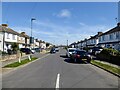
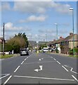
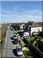
100 photos from this area
Area Information
Key information about the BN15 8EG including its size, population, and administrative classification.
- Area Type
- Postcode
- Area Size
- 6884 m²
- Population
- Not available
- Population Density
- Not available
House Prices in BN15 8EG
23
Properties
£235,958
Average Sold Price
£64,000
Lowest Price
£403,000
Highest Price
Showing 23 properties
| Address | Type | Beds | Baths | Last Sale Price | Last Sale Date | |
|---|---|---|---|---|---|---|
| 77 Kings Road, Lancing, BN15 8EG | Terraced | 2 | 1 | £296,500 | Jun 2024 | |
| 79 Kings Road, Lancing, BN15 8EG | Terraced | 2 | 1 | £315,000 | Feb 2023 | |
| 69 Kings Road, Lancing, BN15 8EG | Terraced | 1 | 1 | £280,000 | Oct 2022 | |
| 73 Kings Road, Lancing, BN15 8EG | Terraced | 3 | 1 | £298,000 | May 2021 | |
| 65 Kings Road, Lancing, BN15 8EG | Semi-detached | - | - | £403,000 | Feb 2021 | |
| 61 Kings Road, Lancing, BN15 8EG | Bungalow | 3 | - | £250,000 | May 2012 | |
| 87 Kings Road, Lancing, BN15 8EG | house | 3 | - | £248,000 | Dec 2011 | |
| 63 Kings Road, Lancing, BN15 8EG | Detached | - | - | £220,000 | Aug 2006 | |
| 71 Kings Road, Lancing, BN15 8EG | Semi-detached | - | - | £158,000 | Dec 2005 | |
| 57 Kings Road, Lancing, BN15 8EG | house | - | - | £220,000 | Mar 2005 |
Page 1 of 3
Energy Efficiency in BN15 8EG
Amenities
Schools
| Rank | School | Type | Entry gender | Ages |
|---|
Explore more schools in this area
Go to Schools tabDemographics
Household Size
Two person
most common
Accommodation Type
Houses
most common
Tenure
83
majority
Ethnic Group
White
most common
Religion
N/A
most common
Household Composition
N/A
most common
Age
47
median
Adults (30-64 years)
most common
Household Deprivation
N/A
with no deprivation
NS-SEC
30
in Lower managerial occupations
Explore more demographic insights in this area
Go to Demographics tabPlanning
Planning Constraints
- Flood RiskPremium
- Ramsar Wetland SitesPremium
- Area of Outstanding Natural BeautyPremium
- Protected Nature ReservePremium
- Protected WoodlandPremium