Area Overview for BN15 8AB
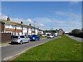
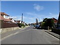
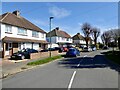
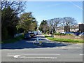
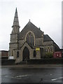
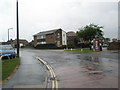
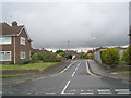
Photos of BN15 8AB

Area Information
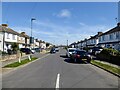
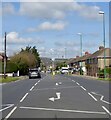
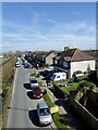
BN15 8AB is a small residential postcode area in West Sussex, part of the larger Lancing village. With a population of just 1,702, it reflects a tight-knit, low-density community. Lancing itself is a coastal village with Saxon origins, situated on the western edge of the Adur Valley. The area is defined by its historical roots, with ancient field boundaries preserved on the South Downs and the River Adur forming its eastern boundary. Modern life here balances suburban convenience with historical character. The village transformed from a 19th-century market gardening hub into a commuter suburb, now integrated into the Brighton/Worthing/Littlehampton conurbation. Residents benefit from proximity to rail links, retail outlets, and two airports. The area’s appeal lies in its manageable size, with amenities within practical reach, and a community profile skewed toward middle-aged adults. While not a high-density urban area, it offers a quieter alternative to nearby towns, with a focus on stability and established living.
- Area Type
- Postcode
- Area Size
- Not available
- Population
- Not available
- Population Density
- Not available
The property market in BN15 8AB is dominated by flats, with 58% of homes owner-occupied. This suggests a mix of long-term residents and a smaller proportion of rental properties. The prevalence of flats, rather than detached or semi-detached homes, indicates a compact housing stock suited to the area’s small size. Given the population of 1,702 and the focus on flats, the market is likely to have limited availability for larger properties. Buyers should consider that the area’s small footprint means competition for homes is concentrated among a specific demographic—middle-aged adults with established needs. The owner-occupation rate implies that many properties are held by residents who have lived in the area for years, which could affect turnover rates. For those seeking investment, the flat-dominated market may present opportunities, but the small scale of the area means limited scope for expansion or development.
House Prices in BN15 8AB
No properties found in this postcode.
Energy Efficiency in BN15 8AB
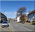
Living in BN15 8AB grants access to a range of amenities within walking or short driving distance. Retailers such as Asda Lancing, Budgens South, and Co-op Lancing provide essential shopping. The rail network, with stations like Lancing and East Worthing, connects residents to broader transport routes. Two airports—Shoreham and Shoreham Brighton City—offer regional travel options. The area’s historical character blends with modern convenience, though specific parks or leisure facilities are not detailed in the data. The presence of retail and transport hubs suggests a lifestyle focused on practicality, with opportunities for both local and regional engagement. The small community size means amenities are concentrated, requiring minimal travel for daily needs.
Amenities
Schools
Near BN15 8AB are two special schools: Springboard Education Senior and Springboard Education, both catering to students with specific educational needs. Springboard Education holds a ‘good’ Ofsted rating, indicating a satisfactory standard of teaching and support. The presence of two special schools suggests the area is well-served for families with children requiring tailored educational provisions. While no mainstream schools are listed, the nearby schools provide a focused option for parents seeking specialist education. This mix supports families prioritising inclusive learning environments but may not cater to those needing traditional state or private schooling. The quality of the rated school offers reassurance for parents, though the absence of broader school options should be considered in the area’s overall appeal.
| Rank | School | Type | Entry gender | Ages |
|---|
Explore more schools in this area
Go to Schools tabDemographics
BN15 8AB has a median age of 47, with the majority of residents aged between 30 and 64. This suggests a community of middle-aged adults, likely settled in long-term housing. Home ownership stands at 58%, indicating a moderate mix of owner-occupied and rental properties. The primary accommodation type is flats, which is notable for a small residential area. The predominant ethnic group is White, reflecting the broader demographic patterns of the region. The population size of 1,702 implies a close-knit community where social ties are likely strong. The absence of specific deprivation data means no direct commentary on economic hardship, but the age profile and home ownership rate suggest a stable, possibly middle-income demographic. The area’s character is shaped by its residents’ life stages, with many likely in their prime working years and focused on family or retirement planning.
Household Size
Accommodation Type
Tenure
Ethnic Group
Religion
Household Composition
Age
Household Deprivation
NS-SEC
Explore more demographic insights in this area
Go to Demographics tabPlanning
Planning Constraints
- Flood RiskPremium
- Ramsar Wetland SitesPremium
- Area of Outstanding Natural BeautyPremium
- Protected Nature ReservePremium
- Protected WoodlandPremium