Area Overview for BN15 0PE
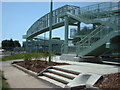
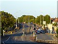
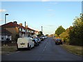
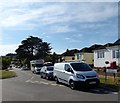
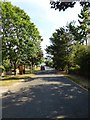
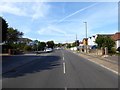
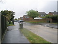
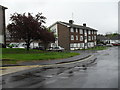
Photos of BN15 0PE
Area Information
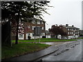
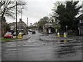
Living in BN15 0PE means inhabiting a small, tightly knit residential cluster in the coastal parish of Lancing, West Sussex. With a population of 1,305, this area blends historical charm with suburban practicality. Lancing itself is a village with Saxon roots, its name possibly derived from “people of Wlanc,” and it sits on the western edge of the Adur Valley, bordered by the River Adur. The area’s character is shaped by its past as a market gardening hub, though today it is predominantly residential. Most homes here are owner-occupied, reflecting a stable community. Daily life is influenced by its proximity to rail networks, with Lancing and East Worthing stations offering regular connections. The area’s low crime risk and absence of environmental constraints make it appealing for families and professionals. Its small size means the community feels close-knit, with local amenities like Co-ops and historic sites such as Lancing College Chapel adding to its distinct identity.
- Area Type
- Postcode
- Area Size
- Not available
- Population
- Not available
- Population Density
- Not available
The property market in BN15 0PE is defined by high home ownership (86%) and a focus on houses rather than flats or apartments. This reflects a suburban, family-oriented area where property is primarily owner-occupied. The small residential cluster means the housing stock is limited, with most homes likely to be older, given the area’s historical roots as a market gardening village. Buyers should consider the proximity to Lancing’s western edge, where commercial development like the Lancing Business Park exists, though this is separate from the residential core. The high ownership rate suggests limited rental availability, making this area more suitable for those seeking long-term stability rather than investment in rental properties. Prospective buyers should also note the area’s integration into the Brighton/Worthing conurbation, offering potential for connectivity to larger urban amenities.
House Prices in BN15 0PE
No properties found in this postcode.
Energy Efficiency in BN15 0PE
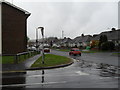
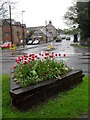
Residents of BN15 0PE have access to a range of local amenities within practical reach. The area is served by five retail outlets, including The Southern Co-operative Co, Co-op Lancing, and Co-op Sompting, ensuring everyday shopping needs are met. Rail connectivity is robust, with Lancing Railway Station, East Worthing Railway Station, and Shoreham providing links to nearby towns and cities. Two airports, Shoreham Airport and Shoreham Brighton City Airport, are also nearby, offering regional travel options. While the data does not mention parks or leisure facilities, the area’s historical roots include sites like St James the Less Church and Lancing College Chapel, which add cultural and architectural interest. The mix of retail, transport, and historical landmarks contributes to a convenient, well-connected lifestyle with a touch of heritage.
Amenities
Schools
| Rank | School | Type | Entry gender | Ages |
|---|
Explore more schools in this area
Go to Schools tabDemographics
BN15 0PE has a median age of 47, with the majority of residents aged between 30 and 64. This suggests a mature, established community, likely with many long-term residents. Home ownership is high at 86%, indicating a strong preference for property investment over rental living. The area is predominantly composed of houses rather than flats or apartments, aligning with its suburban character. The predominant ethnic group is White, though no further diversity data is provided. This demographic profile points to a stable, family-oriented environment with limited generational turnover. The absence of significant deprivation data implies a relatively uniform standard of living, though specific socioeconomic indicators are not detailed. The age range and ownership rates suggest a community focused on long-term residency and local continuity.
Household Size
Accommodation Type
Tenure
Ethnic Group
Religion
Household Composition
Age
Household Deprivation
NS-SEC
Explore more demographic insights in this area
Go to Demographics tabPlanning
Planning Constraints
- Flood RiskPremium
- Ramsar Wetland SitesPremium
- Area of Outstanding Natural BeautyPremium
- Protected Nature ReservePremium
- Protected WoodlandPremium