Area Overview for BN14 9LY
Photos of BN14 9LY
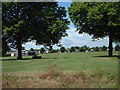
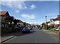


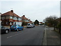
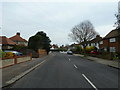

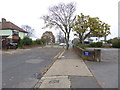
72 photos from this area
Area Information
Key information about the BN14 9LY including its size, population, and administrative classification.
- Area Type
- Postcode
- Area Size
- 1.3 hectares
- Population
- 1518
- Population Density
- 5664 people/km²
House Prices in BN14 9LY
22
Properties
£409,882
Average Sold Price
£49,000
Lowest Price
£819,000
Highest Price
Showing 22 properties
| Address | Type | Beds | Baths | Last Sale Price | Last Sale Date | |
|---|---|---|---|---|---|---|
| 68 Forest Road, Broadwater, Worthing, BN14 9LY | Detached | 6 | 2 | £819,000 | Mar 2025 | |
| 58 Forest Road, Broadwater, Worthing, BN14 9LY | Detached | 3 | 2 | £660,000 | Nov 2023 | |
| 42 Forest Road, Broadwater, Worthing, BN14 9LY | Detached | 4 | 2 | £710,000 | Jul 2022 | |
| 82 Forest Road, Broadwater, Worthing, BN14 9LY | Retail | 2 | 1 | £265,000 | May 2022 | |
| 62 Forest Road, Broadwater, Worthing, BN14 9LY | Flat | 2 | 1 | £250,000 | Dec 2020 | |
| 74 Forest Road, Broadwater, Worthing, BN14 9LY | Detached | 4 | 3 | £620,000 | May 2020 | |
| 54 Forest Road, Broadwater, Worthing, BN14 9LY | Detached | 4 | 3 | £550,000 | Jan 2020 | |
| 72 Forest Road, Broadwater, Worthing, BN14 9LY | Detached | 5 | 2 | £492,000 | Sep 2018 | |
| 46 Forest Road, Broadwater, Worthing, BN14 9LY | Detached | 4 | - | £625,000 | Apr 2018 | |
| 64A Forest Road, Broadwater, Worthing, BN14 9LY | Flat | - | - | £216,000 | Nov 2015 |
Page 1 of 3
Energy Efficiency in BN14 9LY
Amenities
Schools
| Rank | School | Type | Entry gender | Ages |
|---|
Explore more schools in this area
Go to Schools tabDemographics
Household Size
Two person
most common
Accommodation Type
Houses
most common
Tenure
79
majority
Ethnic Group
White
most common
Religion
N/A
most common
Household Composition
N/A
most common
Age
47
median
Adults (30-64 years)
most common
Household Deprivation
N/A
with no deprivation
NS-SEC
40
in Lower managerial occupations
Explore more demographic insights in this area
Go to Demographics tabPlanning
Planning Constraints
- Flood RiskPremium
- Ramsar Wetland SitesPremium
- Area of Outstanding Natural BeautyPremium
- Protected Nature ReservePremium
- Protected WoodlandPremium