Area Overview for BN14 0WL
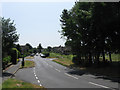
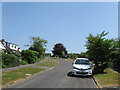
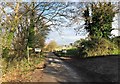
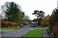
Photos of BN14 0WL


Area Information
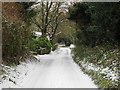
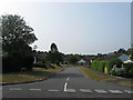
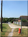
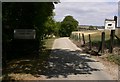
BN14 0WL is a small, semi-rural postcode area in West Sussex, nestled within the South Downs. With a population of 1,189 and a density of 43 people per square kilometre, it retains a village-like character despite its proximity to larger towns. The area’s layout reflects its historical roots as a clustered settlement, centred around historic pathways and agricultural land. Residents benefit from proximity to Worthing, just 4 miles to the south, while the surrounding landscape offers open downland and pastoral vistas. Daily life here is shaped by a mix of traditional and modern influences: the annual sheep fair at Nepcote Green, a centuries-old tradition, coexists with contemporary amenities like local shops and rail links. The area’s compact size means most services are within walking or cycling distance, though its small population ensures a quiet, low-density lifestyle. For those seeking a balance between rural tranquillity and accessible urban conveniences, BN14 0WL offers a distinct blend of heritage and practicality.
- Area Type
- Postcode
- Area Size
- Not available
- Population
- 1189
- Population Density
- 43 people/km²
BN14 0WL is primarily an owner-occupied area, with 70% of homes owned by residents rather than rented. The accommodation type is predominantly houses, reflecting the semi-rural nature of the postcode and its historical development as a clustered village. This contrasts with urban areas where flats or apartments are more common. The limited population and small size of the area mean housing stock is likely older, with properties built to accommodate traditional family structures. For buyers, this suggests a market focused on established homes rather than new-build developments. The low population density also implies limited competition for properties, potentially offering opportunities for those seeking spacious, privately owned homes. However, the small size of the area means buyers must consider proximity to larger towns like Worthing for additional services and employment options.
House Prices in BN14 0WL
No properties found in this postcode.
Energy Efficiency in BN14 0WL
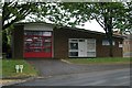
Residents of BN14 0WL have access to nearby retail amenities, including M&S Findon Valley BP, Tesco Worthing, and Co-op Manor, which provide essential shopping and dining options. The area’s semi-rural character is complemented by practical transport links, with five rail stations within reach, offering connections to Worthing and beyond. The proximity to Shoreham Airport adds to the area’s accessibility for travel. Locally, the annual sheep fair at Nepcote Green and historical sites like St John the Baptist Church offer cultural and recreational opportunities. The combination of small-town amenities and nearby urban services creates a lifestyle that balances tradition with convenience. The low population density ensures a quieter environment, though residents must travel further for specialist services or entertainment.
Amenities
Schools
The nearest school to BN14 0WL is Clapham and Patching CofE Primary School, which serves the local community with primary education. The school has an Ofsted rating of satisfactory, indicating it meets basic standards but may have areas for improvement. As a primary school, it caters to children aged 4–11, though no secondary schools are listed in the data. Families relying on this school must consider the need for additional educational provision beyond primary level, potentially requiring travel to nearby towns. The single school option highlights the area’s small size, which may limit educational diversity but also fosters a close-knit community where parents and teachers are likely to know one another.
| Rank | School | Type | Entry gender | Ages |
|---|
Explore more schools in this area
Go to Schools tabDemographics
BN14 0WL has a median age of 47, with the majority of residents falling into the 30–64 age range. This suggests a community skewed towards middle-aged adults, likely reflecting long-term settlement patterns. Home ownership is high at 70%, indicating a stable, owner-occupied demographic. The area is predominantly composed of houses rather than flats, aligning with its semi-rural character. The predominant ethnic group is White, though no specific data on diversity or deprivation levels is provided. The age profile implies a population with established careers and family ties, potentially contributing to a cohesive, long-term community. However, the lack of younger residents or transient populations may affect local amenities and services. The absence of specific data on deprivation means it is unclear whether the area’s quality of life is uniformly high or if certain groups face challenges.
Household Size
Accommodation Type
Tenure
Ethnic Group
Religion
Household Composition
Age
Household Deprivation
NS-SEC
Explore more demographic insights in this area
Go to Demographics tabPlanning
Planning Constraints
- Flood RiskPremium
- Ramsar Wetland SitesPremium
- Area of Outstanding Natural BeautyPremium
- Protected Nature ReservePremium
- Protected WoodlandPremium