Area Overview for BN14 0BL
Photos of BN14 0BL


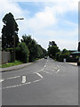
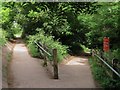
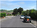
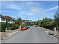

45 photos from this area
Area Information
Key information about the BN14 0BL including its size, population, and administrative classification.
- Area Type
- Postcode
- Area Size
- 2.8 hectares
- Population
- 1719
- Population Density
- 2631 people/km²
House Prices in BN14 0BL
43
Properties
£271,708
Average Sold Price
£53,000
Lowest Price
£555,000
Highest Price
Showing 43 properties
| Address | Type | Beds | Baths | Last Sale Price | Last Sale Date | |
|---|---|---|---|---|---|---|
| 11A Parham Road, Offington, Worthing, BN14 0BL | Bungalow | 3 | 1 | £540,000 | Oct 2024 | |
| 1 Parham Road, Offington, Worthing, BN14 0BL | Bungalow | 2 | 1 | £425,000 | May 2024 | |
| 11 Parham Road, Offington, Worthing, BN14 0BL | Bungalow | 3 | 2 | £475,000 | Mar 2024 | |
| 27 Parham Road, Offington, Worthing, BN14 0BL | Semi-detached | 4 | 2 | £555,000 | Oct 2022 | |
| 40 Parham Road, Offington, Worthing, BN14 0BL | Bungalow | - | - | £372,000 | Feb 2022 | |
| 15 Parham Road, Offington, Worthing, BN14 0BL | Bungalow | 2 | 1 | £315,000 | Dec 2020 | |
| 10 Parham Road, Offington, Worthing, BN14 0BL | Bungalow | - | - | £325,000 | Nov 2020 | |
| 5 Parham Road, Offington, Worthing, BN14 0BL | Bungalow | - | - | £327,000 | Nov 2020 | |
| 26 Parham Road, Offington, Worthing, BN14 0BL | Bungalow | - | - | £300,000 | Jan 2020 | |
| 20 Parham Road, Offington, Worthing, BN14 0BL | Bungalow | 4 | 2 | £420,000 | Dec 2019 |
Page 1 of 5
Energy Efficiency in BN14 0BL
Amenities
Schools
| Rank | School | Type | Entry gender | Ages |
|---|
Explore more schools in this area
Go to Schools tabDemographics
Household Size
Two person
most common
Accommodation Type
Houses
most common
Tenure
83
majority
Ethnic Group
White
most common
Religion
N/A
most common
Household Composition
N/A
most common
Age
47
median
Adults (30-64 years)
most common
Household Deprivation
N/A
with no deprivation
NS-SEC
36
in Lower managerial occupations
Explore more demographic insights in this area
Go to Demographics tabPlanning
Planning Constraints
- Flood RiskPremium
- Ramsar Wetland SitesPremium
- Area of Outstanding Natural BeautyPremium
- Protected Nature ReservePremium
- Protected WoodlandPremium