Area Overview for BN13 3BX
Photos of BN13 3BX


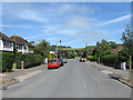
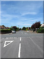
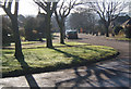
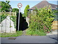
45 photos from this area
Area Information
Key information about the BN13 3BX including its size, population, and administrative classification.
- Area Type
- Postcode
- Area Size
- 4.8 hectares
- Population
- 1296
- Population Density
- 717 people/km²
House Prices in BN13 3BX
18
Properties
£531,346
Average Sold Price
£160,000
Lowest Price
£950,000
Highest Price
Showing 18 properties
| Address | Type | Beds | Baths | Last Sale Price | Last Sale Date | |
|---|---|---|---|---|---|---|
| Thistledown, Gorse Lane, Salvington, Worthing, BN13 3BX | Detached | 3 | 1 | £827,000 | Dec 2023 | |
| Gorse Lane House, Gorse Lane, Salvington, Worthing, BN13 3BX | Detached | 5 | 3 | £950,000 | Oct 2023 | |
| Silver Birches, Gorse Lane, Salvington, Worthing, BN13 3BX | house | - | - | £700,000 | Apr 2021 | |
| High View, Gorse Lane, Salvington, Worthing, BN13 3BX | Bungalow | 4 | 2 | £750,000 | Dec 2020 | |
| Camellia House, Gorse Lane, Salvington, Worthing, BN13 3BX | house | - | - | £600,000 | May 2012 | |
| Former Moonrakers, Gorse Lane, Salvington, Worthing, BN13 3BX | Detached | 3 | 1 | £320,000 | Sep 2010 | |
| Rest Harrow, Gorse Lane, Salvington, Worthing, BN13 3BX | Detached | - | - | £620,000 | Aug 2008 | |
| High Beech, Gorse Lane, Salvington, Worthing, BN13 3BX | Detached | 4 | 3 | £450,000 | Jul 2006 | |
| Faversham Lodge, Gorse Lane, Salvington, Worthing, BN13 3BX | Detached | - | - | £585,000 | May 2006 | |
| Greenacres, Gorse Lane, Salvington, Worthing, BN13 3BX | Detached | - | - | £315,000 | Mar 2004 |
Page 1 of 2
Energy Efficiency in BN13 3BX
Amenities
Schools
| Rank | School | Type | Entry gender | Ages |
|---|
Explore more schools in this area
Go to Schools tabDemographics
Household Size
Two person
most common
Accommodation Type
Houses
most common
Tenure
96
majority
Ethnic Group
White
most common
Religion
N/A
most common
Household Composition
N/A
most common
Age
47
median
Adults (30-64 years)
most common
Household Deprivation
N/A
with no deprivation
NS-SEC
49
in Lower managerial occupations
Explore more demographic insights in this area
Go to Demographics tabPlanning
Planning Constraints
- Flood RiskPremium
- Ramsar Wetland SitesPremium
- Area of Outstanding Natural BeautyPremium
- Protected Nature ReservePremium
- Protected WoodlandPremium