Area Overview for BN13 2WG
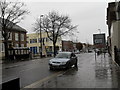
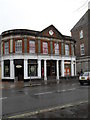
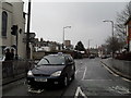
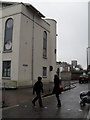
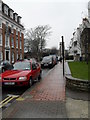
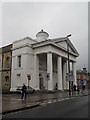
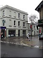
Photos of BN13 2WG

Area Information
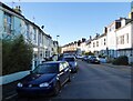
BN13 2WG is a small residential cluster in the coastal town of Worthing, West Sussex. With a population of 2,123, it forms part of the Worthing West parliamentary constituency and is governed by Worthing Borough Council. The area’s compact size and established character reflect its role as a traditional urban ward in a seaside town. Property values here sit in the mid-range for the region, with an average new-build sale price of £277,032 and a price per square metre of £3,767. This suggests a mix of older and newer homes catering to a range of buyers. The proximity to the coast, combined with nearby transport links, makes it appealing for those seeking a balance between coastal living and urban convenience. Daily life here is shaped by its small-scale community, with local amenities and schools within practical reach. The area’s residential focus, with a predominance of houses, offers a distinct contrast to high-density housing, creating a more private, family-oriented environment.
- Area Type
- Postcode
- Area Size
- Not available
- Population
- 2123
- Population Density
- 9131 people/km²
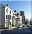
The property market in BN13 2WG is characterised by a 53% home ownership rate, with houses being the primary accommodation type. This suggests a community of homeowners rather than a rental-dominated area, though nearly half of properties are likely rented. The average new-build sale price of £277,032 and price per square metre of £3,767 position the area in the mid-range for Worthing’s wards, indicating a mix of established homes and newer developments. As a small residential cluster, the housing stock is unlikely to have significant variations in price or size, making it predictable for buyers. The predominance of houses over flats or apartments may appeal to families seeking more space, though the limited scale of the area means buyers should consider nearby suburbs for broader options. The mid-range pricing and stable ownership rates suggest a market that is neither overly competitive nor undervalued, offering a pragmatic choice for those seeking a coastal town with practical living conditions.
House Prices in BN13 2WG
No properties found in this postcode.
Energy Efficiency in BN13 2WG
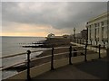
The lifestyle in BN13 2WG is shaped by its proximity to retail, transport, and travel hubs. Local shops such as Lidl Central, Tesco Worthing, and Waitrose Worthing provide access to daily essentials, while the five nearby railway stations—Worthing, East Worthing, and West Worthing—offer seamless connections to major cities and towns. The presence of two airports, Shoreham and Shoreham Brighton City, adds convenience for frequent flyers. Though the area itself is small, its integration with Worthing’s broader infrastructure ensures residents can enjoy coastal amenities, cultural attractions, and employment opportunities beyond the immediate postcode. The mix of retail, transport, and travel options creates a practical, accessible environment, ideal for those prioritising connectivity and convenience without sacrificing the charm of a coastal town.
Amenities
Schools
BN13 2WG is served by two independent schools: Cura Academy and Educate U. Educate U holds an Ofsted rating of ‘good’, indicating a satisfactory standard of education. Both institutions cater to families seeking private schooling, though no state schools are listed in the data. The presence of independent schools suggests the area may attract households prioritising non-state education, though parents seeking state-funded options would need to look further afield. The absence of specific data on school catchment areas or student performance means the quality of education cannot be fully assessed beyond the Ofsted rating. For families valuing choice in schooling, the availability of two independent options provides some flexibility, though the limited number may necessitate commuting for state schools.
| Rank | School | Type | Entry gender | Ages |
|---|
Explore more schools in this area
Go to Schools tabDemographics
BN13 2WG has a median age of 47, with the most common age range being adults aged 30–64. This suggests a mature, stable population, likely with long-term ties to the area. Home ownership stands at 53%, indicating that nearly half of residents own their properties, while the remaining 47% may be renters or in other tenures. The accommodation type is predominantly houses, reflecting a residential area without high-rise buildings or flats. The predominant ethnic group is White, though the data does not provide further details on diversity or minority representation. The age profile and ownership figures suggest a community of middle-aged individuals, many of whom may be settled in long-term careers or retirement. The absence of specific data on deprivation means the area’s socioeconomic challenges cannot be assessed, but the mid-range property prices and moderate ownership rates imply a balanced mix of economic backgrounds.
Household Size
Accommodation Type
Tenure
Ethnic Group
Religion
Household Composition
Age
Household Deprivation
NS-SEC
Explore more demographic insights in this area
Go to Demographics tabPlanning
Planning Constraints
- Flood RiskPremium
- Ramsar Wetland SitesPremium
- Area of Outstanding Natural BeautyPremium
- Protected Nature ReservePremium
- Protected WoodlandPremium