Area Overview for BN13 2WD
Photos of BN13 2WD
Area Information
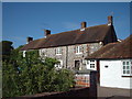
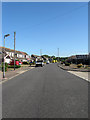
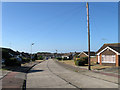
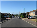
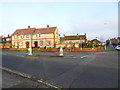
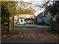
BN13 2WD is a small residential postcode area in the Borough of Worthing, West Sussex, encompassing parts of Durrington and surrounding streets. With a population of 1371, it is a tightly knit community characterised by its proximity to Worthing’s urban core and access to nearby natural and transport links. The area is part of the Worthing West parliamentary constituency and includes locations such as Durrington Lane and Greenland Road. Daily life here is shaped by its compact size and integration with local services. Residents benefit from nearby rail stations, including Durrington and West Worthing, which connect to Brighton and beyond. The area’s broadband score of 100 ensures seamless digital connectivity, supporting both remote work and leisure. While it is a residential cluster, its small footprint means it is best suited for those seeking a quiet, established neighbourhood with easy access to larger towns. The presence of Durrington Health Centre and nearby hospitals underscores the area’s commitment to healthcare, while its proximity to Shoreham Airport adds to its practicality for travel. BN13 2WD is a snapshot of suburban England, where stability and convenience meet.
- Area Type
- Postcode
- Area Size
- Not available
- Population
- Not available
- Population Density
- Not available
The property market in BN13 2WD is characterised by a high rate of home ownership (79%) and a predominance of houses. This indicates a market skewed towards owner-occupied properties rather than rental units, which is common in established residential areas. The focus on houses suggests a preference for family homes or larger properties, which may appeal to buyers seeking stability and space. Given the area’s small size, the housing stock is likely limited, meaning buyers should consider nearby postcodes such as BN13 2RW or BN13 2SN for additional options. The compact nature of BN13 2WD means property availability may be constrained, but the high home ownership rate suggests a resilient market with long-term residents. Buyers should also note that the area’s proximity to transport links and amenities may enhance its appeal, though competition for properties could be higher due to its desirability.
House Prices in BN13 2WD
No properties found in this postcode.
Energy Efficiency in BN13 2WD
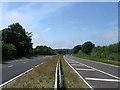
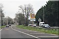
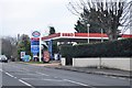
Living in BN13 2WD offers access to a range of essential amenities within practical reach. Retail options include Co-op Manor, Tesco Durrington, and Co-op Durrington, providing everyday shopping needs. The area’s rail network, with stations at Durrington, West Worthing, and Goring, ensures easy access to larger towns and cities. Nearby airports, such as Shoreham and Shoreham Brighton City, cater to regional and domestic travel. The presence of Durrington Health Centre highlights the area’s healthcare infrastructure, while the proximity to Worthing’s urban centres adds to its convenience. The compact nature of BN13 2WD means daily life is efficient, with services and transport within walking or short driving distance. This balance of local amenities and connectivity supports a practical, low-stress lifestyle, ideal for those prioritising accessibility and ease of movement.
Amenities
Schools
| Rank | School | Type | Entry gender | Ages |
|---|
Explore more schools in this area
Go to Schools tabDemographics
The community in BN13 2WD is predominantly composed of adults aged 30–64, with a median age of 47. This suggests a mature, established population, likely with long-term ties to the area. Home ownership is high at 79%, indicating a strong presence of owner-occupied properties, which is typical of suburban areas. The accommodation type is primarily houses, reflecting a lower density of flats or apartments. The predominant ethnic group is White, which aligns with broader trends in the region. The absence of specific deprivation data means the area’s socioeconomic profile is not explicitly detailed, but the high home ownership rate and median age imply a relatively stable and middle-income demographic. The age range suggests a mix of professionals, families, and retirees, contributing to a balanced community dynamic.
Household Size
Accommodation Type
Tenure
Ethnic Group
Religion
Household Composition
Age
Household Deprivation
NS-SEC
Explore more demographic insights in this area
Go to Demographics tabPlanning
Planning Constraints
- Flood RiskPremium
- Ramsar Wetland SitesPremium
- Area of Outstanding Natural BeautyPremium
- Protected Nature ReservePremium
- Protected WoodlandPremium