Area Overview for BN13 2PY
Photos of BN13 2PY

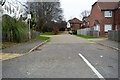
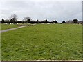
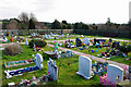
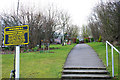


19 photos from this area
Area Information
Key information about the BN13 2PY including its size, population, and administrative classification.
- Area Type
- Postcode
- Area Size
- 8376 m²
- Population
- 1614
- Population Density
- 6225 people/km²
House Prices in BN13 2PY
14
Properties
£350,409
Average Sold Price
£165,000
Lowest Price
£695,000
Highest Price
Showing 14 properties
| Address | Type | Beds | Baths | Last Sale Price | Last Sale Date | |
|---|---|---|---|---|---|---|
| Willmar, Durrington Hill, Salvington, Worthing, BN13 2PY | Bungalow | 2 | - | £490,000 | Oct 2024 | |
| Four Trees, Durrington Hill, Salvington, Worthing, BN13 2PY | Bungalow | 3 | 1 | £423,500 | Mar 2024 | |
| Avon Cottage, Durrington Hill, Salvington, Worthing, BN13 2PY | Detached | 4 | 2 | £695,000 | Jan 2024 | |
| Bluebells, Durrington Hill, Salvington, Worthing, BN13 2PY | Detached | 4 | 2 | £580,000 | May 2019 | |
| Elm Bank House, Durrington Hill, Salvington, Worthing, BN13 2PY | Detached | 4 | 3 | £440,000 | Nov 2015 | |
| Fryston, Durrington Hill, Salvington, Worthing, BN13 2PY | Bungalow | 3 | 1 | £200,000 | Jun 2012 | |
| Fern Cottage, Durrington Hill, Salvington, Worthing, BN13 2PY | house | 2 | 2 | £220,000 | Feb 2010 | |
| Woodcroft, Durrington Hill, Salvington, Worthing, BN13 2PY | house | 2 | - | £215,000 | Jan 2010 | |
| Thistledown, Durrington Hill, Salvington, Worthing, BN13 2PY | Detached | - | - | £250,000 | Jan 2003 | |
| Comptons Cottage, Durrington Hill, Salvington, Worthing, BN13 2PY | Detached | - | - | £165,000 | Mar 2001 |
Page 1 of 2
Energy Efficiency in BN13 2PY
Amenities
Schools
| Rank | School | Type | Entry gender | Ages |
|---|
Explore more schools in this area
Go to Schools tabDemographics
Household Size
Two person
most common
Accommodation Type
Houses
most common
Tenure
65
majority
Ethnic Group
White
most common
Religion
N/A
most common
Household Composition
N/A
most common
Age
47
median
Adults (30-64 years)
most common
Household Deprivation
N/A
with no deprivation
NS-SEC
26
in Lower managerial occupations
Explore more demographic insights in this area
Go to Demographics tabPlanning
Planning Constraints
- Flood RiskPremium
- Ramsar Wetland SitesPremium
- Area of Outstanding Natural BeautyPremium
- Protected Nature ReservePremium
- Protected WoodlandPremium