Area Overview for BN13 2JY
Photos of BN13 2JY


Area Information
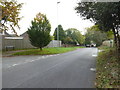
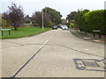
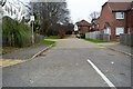
Durrington Ward in Worthing sits within the BN13 2JY postcode, covering a compact residential cluster that spans just 2198 square metres. This small, defined area forms part of the larger electoral ward and parliamentary constituency, offering a tight-knit setting for residents. The population stands at 1371 people, creating a dense neighbourhood where daily interactions are frequent yet contained within a specific geographical boundary. You will find that life here revolves around the immediate surroundings, with homes situated on streets like Durrington Lane and Greenland Road. The locality blends seamlessly with adjacent regions, providing access to wider infrastructure without sacrificing a sense of place. Living in BN13 2JY means embracing a practical, accessible lifestyle within the Borough of Worthing. The area functions as a recognised residential zone, anchored by local services and connected to south-east England's transport network. Whether you are navigating from the entrance of this specific cluster or visiting from nearby Durrington Ranges, the facility offers consistent housing options for families and individuals. The postcode serves as a specific identifier for this residential group, distinct from neighbouring areas but sharing the same broader municipal services. You can expect a focused community dynamic where the limited land area dictates the pace and scale of local development.
- Area Type
- Postcode
- Area Size
- 2198 m²
- Population
- Not available
- Population Density
- Not available
Homes in BN13 2JY are overwhelmingly the property of individuals who have bought them outright. The home ownership rate reaches 79 percent, placing this postcode firmly within the owner-occupied sector rather than the rental market. You are far more likely to meet a family that has lived in their seat since purchase than a tenant looking for a short-term lease. This high level of ownership typically correlates with stable, long-term residents who view their property as a permanent investment in the area. The accommodation type is exclusively houses, meaning you will not find flats or apartments within this specific cluster. This housing stock suits buyers seeking traditional dwellings rather than urban-adjacent living. When searching for BN13 2JY, you engage with a market where property turnover relies heavily on sales between current and future owners. The limited area size of 2198 square metres restricts the volume of available inventory, making each property transaction significant for the local market balance. Prospective buyers should approach this area as a purchase zone where stability and ownership are the defining characteristics of the housing landscape.
House Prices in BN13 2JY
Showing 53 properties
Energy Efficiency in BN13 2JY
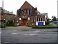
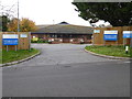
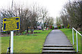
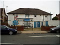
Retail options within practical reach of BN13 2JY include Co-op Manor, Co-op Durrington, and Tesco Durrington. These five retail locations offer essential shopping for groceries and daily necessities without a lengthy commute. You can complete your weekly shop at Tesco Durrington or use Co-op Manor for specific product requirements. The area also benefits from five railway stations nearby, including Durrington, West Worthing, and Goring. Access to air travel is quick, with Shoreham Airport and Shoreham Brighton City Airport located just away. Residents can reach these two airports easily for both business and leisure trips. The named features of the area, such as Durrington Health Centre, provide convenient access to medical care within the Worthing framework. These amenities create a functional lifestyle where daily needs are met locally, while wider travel options remain accessible. The presence of specific shops and transport hubs defines the rhythm of life here, eliminating the need to travel far for routine errands.
Amenities
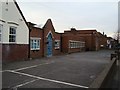
Schools
| Rank | School | Type | Entry gender | Ages |
|---|
Explore more schools in this area
Go to Schools tabDemographics
The community within BN13 2JY reflects a mature demographic profile with a median age of 47 years. Most residents fall into the adult age range of 30 to 64 years, suggesting a population dominated by individuals in their prime working or semi-retired years. You will encounter a settled group rather than a transient one, as 79 percent of households have purchased their accommodation. This high ownership rate indicates strong community stability and long-term investment in the neighbourhood. Homes in this area are predominantly houses, which aligns with the tendency of owners to select property types they have inhabited for generations. The ethnic composition is primarily White, mirroring the broader demographic trends in this part of West Sussex. With a population density of 623690 people per square kilometre, the area is tightly packed, incentivising respectful neighbourly conduct and shared use of limited public spaces. The age structure and ownership figures suggest a stable environment where families and established adults form the backbone of the social fabric. Living in BN13 2JY requires acceptance of a homogeneous yet mature social environment defined by these clear statistical realities.
Household Size
Accommodation Type
Tenure
Ethnic Group
Religion
Household Composition
Age
Household Deprivation
NS-SEC
Explore more demographic insights in this area
Go to Demographics tabPlanning
Planning Constraints
- Flood RiskPremium
- Ramsar Wetland SitesPremium
- Area of Outstanding Natural BeautyPremium
- Protected Nature ReservePremium
- Protected WoodlandPremium