Area Overview for BN13 2BG
Photos of BN13 2BG

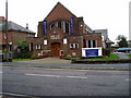
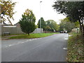
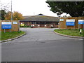
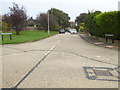
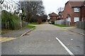
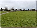

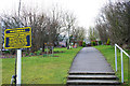
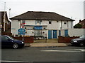

19 photos from this area
Area Information
Key information about the BN13 2BG including its size, population, and administrative classification.
- Area Type
- Postcode
- Area Size
- 6740 m²
- Population
- Not available
- Population Density
- Not available
House Prices in BN13 2BG
19
Properties
£229,302
Average Sold Price
£36,500
Lowest Price
£400,000
Highest Price
Showing 19 properties
| Address | Type | Beds | Baths | Last Sale Price | Last Sale Date | |
|---|---|---|---|---|---|---|
| 88 Stone Lane, Salvington, Worthing, BN13 2BG | Flat | - | - | £205,567 | Nov 2022 | |
| 72 Stone Lane, Salvington, Worthing, BN13 2BG | house | - | - | £370,000 | Jun 2021 | |
| 102 Stone Lane, Salvington, Worthing, BN13 2BG | Flat | - | - | £207,000 | Apr 2021 | |
| 68 Stone Lane, Salvington, Worthing, BN13 2BG | Semi-detached | 3 | 1 | £400,000 | Mar 2021 | |
| 80 Stone Lane, Salvington, Worthing, BN13 2BG | Detached | 3 | - | £390,000 | Mar 2019 | |
| 100 Stone Lane, Salvington, Worthing, BN13 2BG | Flat | - | - | £194,000 | May 2017 | |
| 70 Stone Lane, Salvington, Worthing, BN13 2BG | Semi-detached | - | - | £222,500 | Jul 2008 | |
| 90 Stone Lane, Salvington, Worthing, BN13 2BG | Flat | - | - | £139,950 | Jul 2005 | |
| 104 Stone Lane, Salvington, Worthing, BN13 2BG | Flat | - | - | £127,500 | May 2004 | |
| 86 Stone Lane, Salvington, Worthing, BN13 2BG | Flat | - | - | £36,500 | Oct 1995 |
Page 1 of 2
Energy Efficiency in BN13 2BG
Amenities
Schools
| Rank | School | Type | Entry gender | Ages |
|---|
Explore more schools in this area
Go to Schools tabDemographics
Household Size
Two person
most common
Accommodation Type
Houses
most common
Tenure
81
majority
Ethnic Group
White
most common
Religion
N/A
most common
Household Composition
N/A
most common
Age
47
median
Adults (30-64 years)
most common
Household Deprivation
N/A
with no deprivation
NS-SEC
34
in Lower managerial occupations
Explore more demographic insights in this area
Go to Demographics tabPlanning
Planning Constraints
- Flood RiskPremium
- Ramsar Wetland SitesPremium
- Area of Outstanding Natural BeautyPremium
- Protected Nature ReservePremium
- Protected WoodlandPremium