Area Overview for BN13 2AD
Photos of BN13 2AD
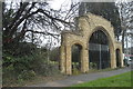
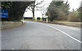
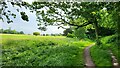
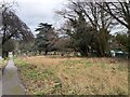
23 photos from this area
Area Information
Key information about the BN13 2AD including its size, population, and administrative classification.
- Area Type
- Postcode
- Area Size
- 1.4 hectares
- Population
- Not available
- Population Density
- Not available
House Prices in BN13 2AD
22
Properties
£309,885
Average Sold Price
£125,000
Lowest Price
£550,000
Highest Price
Showing 22 properties
| Address | Type | Beds | Baths | Last Sale Price | Last Sale Date | |
|---|---|---|---|---|---|---|
| 19 The Glen, Salvington, Worthing, BN13 2AD | Bungalow | 2 | 1 | £420,000 | Mar 2024 | |
| 21 The Glen, Salvington, Worthing, BN13 2AD | Bungalow | 3 | 1 | £465,000 | Jul 2019 | |
| 1 The Glen, Salvington, Worthing, BN13 2AD | Detached | 2 | 1 | £375,000 | Aug 2018 | |
| 11 The Glen, Salvington, Worthing, BN13 2AD | Bungalow | - | - | £330,000 | May 2018 | |
| 49 The Glen, Salvington, Worthing, BN13 2AD | Bungalow | 4 | 3 | £550,000 | Mar 2018 | |
| 17 The Glen, Salvington, Worthing, BN13 2AD | house | - | - | £250,000 | Oct 2011 | |
| 35 The Glen, Salvington, Worthing, BN13 2AD | Bungalow | 3 | - | £335,000 | Dec 2010 | |
| 39 The Glen, Salvington, Worthing, BN13 2AD | house | - | - | £247,500 | May 2009 | |
| 41 The Glen, Salvington, Worthing, BN13 2AD | Bungalow | 3 | 1 | £325,000 | Jul 2008 | |
| 3 The Glen, Salvington, Worthing, BN13 2AD | Detached | - | - | £210,000 | Dec 2005 |
Page 1 of 3
Energy Efficiency in BN13 2AD
Amenities
Schools
| Rank | School | Type | Entry gender | Ages |
|---|
Explore more schools in this area
Go to Schools tabDemographics
Household Size
Two person
most common
Accommodation Type
Houses
most common
Tenure
81
majority
Ethnic Group
White
most common
Religion
N/A
most common
Household Composition
N/A
most common
Age
47
median
Adults (30-64 years)
most common
Household Deprivation
N/A
with no deprivation
NS-SEC
34
in Lower managerial occupations
Explore more demographic insights in this area
Go to Demographics tabPlanning
Planning Constraints
- Flood RiskPremium
- Ramsar Wetland SitesPremium
- Area of Outstanding Natural BeautyPremium
- Protected Nature ReservePremium
- Protected WoodlandPremium