Area Overview for BN13 1JT
Photos of BN13 1JT

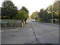
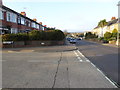
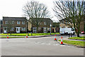
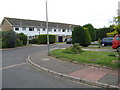

14 photos from this area
Area Information
Key information about the BN13 1JT including its size, population, and administrative classification.
- Area Type
- Postcode
- Area Size
- 1.1 hectares
- Population
- Not available
- Population Density
- Not available
House Prices in BN13 1JT
14
Properties
£300,583
Average Sold Price
£139,000
Lowest Price
£660,000
Highest Price
Showing 14 properties
| Address | Type | Beds | Baths | Last Sale Price | Last Sale Date | |
|---|---|---|---|---|---|---|
| 77 The Boulevard, Castle, Worthing, BN13 1JT | house | 3 | 2 | £660,000 | Oct 2023 | |
| 69 The Boulevard, Castle, Worthing, BN13 1JT | house | - | - | £355,000 | Oct 2013 | |
| 67 The Boulevard, Castle, Worthing, BN13 1JT | Detached | 3 | - | £315,000 | Jan 2013 | |
| 85 The Boulevard, Castle, Worthing, BN13 1JT | house | - | - | £324,000 | Aug 2012 | |
| 59 The Boulevard, Castle, Worthing, BN13 1JT | Detached | 4 | 1 | £395,000 | Sep 2007 | |
| 61 The Boulevard, Castle, Worthing, BN13 1JT | Semi-detached | - | - | £186,250 | Feb 2001 | |
| 63 The Boulevard, Castle, Worthing, BN13 1JT | Semi-detached | - | - | £188,000 | Jun 2000 | |
| 71 The Boulevard, Castle, Worthing, BN13 1JT | Semi-detached | - | - | £139,000 | Mar 1999 | |
| 73 The Boulevard, Castle, Worthing, BN13 1JT | Detached | 4 | 1 | £143,000 | Jan 1999 | |
| 79 The Boulevard, Castle, Worthing, BN13 1JT | Detached | 3 | 1 | - | - |
Page 1 of 2
Energy Efficiency in BN13 1JT
Amenities
Schools
| Rank | School | Type | Entry gender | Ages |
|---|
Explore more schools in this area
Go to Schools tabDemographics
Household Size
Two person
most common
Accommodation Type
Houses
most common
Tenure
84
majority
Ethnic Group
White
most common
Religion
N/A
most common
Household Composition
N/A
most common
Age
47
median
Adults (30-64 years)
most common
Household Deprivation
N/A
with no deprivation
NS-SEC
35
in Lower managerial occupations
Explore more demographic insights in this area
Go to Demographics tabPlanning
Planning Constraints
- Flood RiskPremium
- Ramsar Wetland SitesPremium
- Area of Outstanding Natural BeautyPremium
- Protected Nature ReservePremium
- Protected WoodlandPremium