Area Overview for BN13 1AZ
Photos of BN13 1AZ
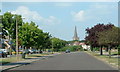
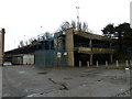
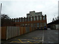
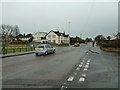
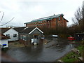
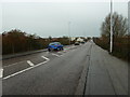
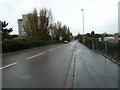
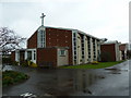
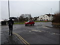
67 photos from this area
Area Information
Key information about the BN13 1AZ including its size, population, and administrative classification.
- Area Type
- Postcode
- Area Size
- 3.3 hectares
- Population
- Not available
- Population Density
- Not available
House Prices in BN13 1AZ
15
Properties
£224,667
Average Sold Price
£44,500
Lowest Price
£372,500
Highest Price
Showing 15 properties
| Address | Type | Beds | Baths | Last Sale Price | Last Sale Date | |
|---|---|---|---|---|---|---|
| 19 Lincett Drive, Tarring, Worthing, BN13 1AZ | Terraced | 3 | 1 | £333,000 | Jul 2025 | |
| 3 Lincett Drive, Tarring, Worthing, BN13 1AZ | Terraced | 3 | 1 | £372,500 | Mar 2025 | |
| 8 Lincett Drive, Tarring, Worthing, BN13 1AZ | Terraced | 3 | 2 | £360,000 | Jun 2022 | |
| 5 Lincett Drive, Tarring, Worthing, BN13 1AZ | Terraced | 3 | 1 | £174,000 | May 2013 | |
| 21 Lincett Drive, Tarring, Worthing, BN13 1AZ | Terraced | - | - | £64,000 | Jun 1998 | |
| 17 Lincett Drive, Tarring, Worthing, BN13 1AZ | house | 3 | - | £44,500 | Jun 1995 | |
| 1 Lincett Drive, Tarring, Worthing, BN13 1AZ | Semi-detached | 3 | - | - | - | |
| Public Conveniences, Allotments West Tarring, Princess Avenue, Tarring, Worthing, BN13 1AZ | commercial | - | - | - | - | |
| 11 Lincett Drive, Tarring, Worthing, BN13 1AZ | Terraced | - | - | - | - | |
| 9 Lincett Drive, Tarring, Worthing, BN13 1AZ | Terraced | - | - | - | - |
Page 1 of 2
Energy Efficiency in BN13 1AZ
Amenities
Schools
| Rank | School | Type | Entry gender | Ages |
|---|
Explore more schools in this area
Go to Schools tabDemographics
Household Size
One person
most common
Accommodation Type
Houses
most common
Tenure
58
majority
Ethnic Group
White
most common
Religion
N/A
most common
Household Composition
N/A
most common
Age
47
median
Adults (30-64 years)
most common
Household Deprivation
N/A
with no deprivation
NS-SEC
29
in Lower managerial occupations
Explore more demographic insights in this area
Go to Demographics tabPlanning
Planning Constraints
- Flood RiskPremium
- Ramsar Wetland SitesPremium
- Area of Outstanding Natural BeautyPremium
- Protected Nature ReservePremium
- Protected WoodlandPremium