Area Overview for BN12 6EA
Photos of BN12 6EA


Area Information
BN12 6EA is a small residential postcode area in England, home to 1,599 people. It is a tightly knit community, characterised by a predominance of houses rather than flats, reflecting a focus on family-oriented living. The area’s population is predominantly adults aged 30–64, with a median age of 47, suggesting a mature demographic with established roots. Daily life here is shaped by proximity to essential services, including five retail outlets such as Asda Durrington and Morrisons Daily Goring-by, alongside accessible rail links to Durrington and West Worthing stations. The area’s connectivity is further bolstered by two nearby airports, Shoreham and Shoreham Brighton City, offering easy travel options. While the postcode is compact, it is well-served by infrastructure, making it a practical choice for those seeking a balance between residential tranquillity and accessibility. The presence of Durrington High School, both primary and academy, underscores the area’s appeal to families, though the small scale of the community means its character is defined by close-knit neighbourly interactions and a reliance on nearby amenities.
- Area Type
- Postcode
- Area Size
- Not available
- Population
- Not available
- Population Density
- Not available
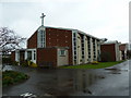
BN12 6EA is predominantly an owner-occupied area, with 79% of properties owned by their residents. The housing stock is almost entirely composed of houses, rather than flats or apartments, which is uncommon in many parts of the UK. This suggests a community that values private, detached living, often associated with suburban or semi-rural settings. The small scale of the postcode means the property market is limited to a handful of homes, making it a niche area for buyers. Those seeking larger properties or family homes may find the available stock sufficient, but those looking for rental options or a broader selection will need to consider nearby areas. The high home ownership rate and focus on houses indicate a market where long-term residency is the norm, with limited speculative investment activity. Buyers should be aware that the area’s size restricts availability, though the presence of nearby amenities and transport links may offset this limitation.
House Prices in BN12 6EA
No properties found in this postcode.
Energy Efficiency in BN12 6EA
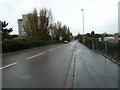
Residents of BN12 6EA have access to a range of amenities within practical reach. The area includes five retail outlets, such as Asda Durrington and Morrisons Daily Goring-by, offering everyday shopping and convenience. These stores cater to household needs, from groceries to general goods. The rail network, with stations at Durrington, West Worthing, and Goring, provides easy access to nearby towns, enhancing connectivity for work, leisure, and socialising. Proximity to two airports—Shoreham and Shoreham Brighton City—adds to the area’s appeal for those requiring frequent travel. While the data does not specify parks or leisure facilities, the presence of schools and retail options suggests a community-focused lifestyle. The combination of retail, transport, and travel links offers a balanced approach to daily living, blending practicality with accessibility. For those prioritising convenience, the area’s amenities are well-suited to a lifestyle that values ease of movement and local services.
Amenities
Schools
The nearest schools to BN12 6EA include Durrington High School, which operates as both a primary and academy school. The academy branch holds a ‘good’ Ofsted rating, reflecting its performance in education and student outcomes. The dual presence of primary and secondary education under the same name suggests a well-integrated school system for families, reducing the need to commute to other areas for schooling. For parents, this offers convenience and continuity in a child’s education. However, the data does not specify the number of students or the school’s capacity, so it is unclear whether the institution serves the entire local population or only a portion of it. The ‘good’ rating indicates that the school meets acceptable standards, but prospective families should consider visiting or contacting the school directly for more detailed insights into its offerings.
| Rank | School | Type | Entry gender | Ages |
|---|
Explore more schools in this area
Go to Schools tabDemographics
The population of BN12 6EA is predominantly adults aged 30–64, with a median age of 47. This suggests a community of established residents, many of whom may be in their prime working years or nearing retirement. Home ownership is high, with 79% of properties owner-occupied, indicating a stable housing market and a preference for long-term residency. The accommodation type is almost exclusively houses, reflecting a lack of high-density housing typical of urban areas. The predominant ethnic group is White, though no specific data on diversity or deprivation is provided. The age profile and ownership figures suggest a community focused on family living, with fewer young households or transient populations. The absence of flats or rental properties implies limited turnover in the housing stock, which could influence property values and the local economy. The demographic makeup aligns with a quiet, settled area where residents are likely to prioritise stability over rapid change.
Household Size
Accommodation Type
Tenure
Ethnic Group
Religion
Household Composition
Age
Household Deprivation
NS-SEC
Explore more demographic insights in this area
Go to Demographics tabPlanning
Planning Constraints
- Flood RiskPremium
- Ramsar Wetland SitesPremium
- Area of Outstanding Natural BeautyPremium
- Protected Nature ReservePremium
- Protected WoodlandPremium