Area Overview for BN12 5NT
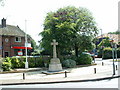
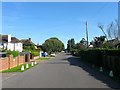
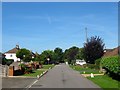
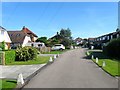
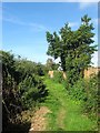
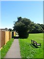
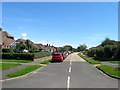
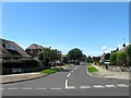
Photos of BN12 5NT

Area Information
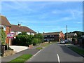
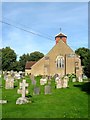
BN12 5NT is a small residential postcode in the coastal village of Ferring, West Sussex, with a population of 1,430. Situated on the A259 road, it blends rural heritage with suburban convenience, nestled near the historic parish of Ferring, which dates back to Saxon times. The area retains a quiet, village-like character, shaped by its Norman church, medieval bridges, and 1920s expansion of holiday homes. While part of the larger Worthing built-up area, it feels distinct, with a focus on low-density housing and proximity to coastal landscapes. Daily life here is defined by a slower pace, with access to nearby amenities in Worthing and the surrounding countryside. The postcode covers a compact cluster of homes, many of which are owner-occupied, reflecting a stable, long-term community. Its location offers a balance between seclusion and connectivity, with nearby rail links and retail options. For buyers seeking a peaceful yet accessible coastal lifestyle, BN12 5NT presents a unique blend of historical charm and modern practicality.
- Area Type
- Postcode
- Area Size
- Not available
- Population
- Not available
- Population Density
- Not available
The property market in BN12 5NT is characterised by high home ownership (89%) and a predominance of houses over flats. This indicates a market skewed towards owner-occupied properties, likely attracting buyers seeking long-term stability or retirement homes. The scarcity of rental properties suggests limited turnover, which could make the area less appealing to investors or those requiring short-term tenancies. The housing stock is primarily composed of larger, individual homes, reflecting the demographic profile of older residents. Given the small size of the postcode and its integration into the wider Ferring and Worthing areas, buyers should consider exploring nearby zones for additional options. The market’s focus on owner-occupation means properties may hold value over time, but competition for available homes could be fierce due to the area’s limited supply.
House Prices in BN12 5NT
No properties found in this postcode.
Energy Efficiency in BN12 5NT
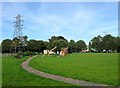
Residents of BN12 5NT have access to a range of nearby amenities, including retail options such as The Southern Co-operative Co, Asda Ferring, and Tesco Goring. These stores provide essential shopping and grocery needs within practical reach. The area also benefits from multiple railway stations—Goring, Durrington, and Angmering—offering connections to regional and national transport networks. While the data does not mention parks or leisure facilities, the proximity to Ferring’s historic sites, such as St Andrew’s church and Highdown Hill, suggests opportunities for walking, historical exploration, and outdoor activities. The combination of retail convenience, transport links, and nearby natural and cultural landmarks contributes to a lifestyle that balances practicality with the charm of a small coastal community.
Amenities
Schools
The nearest school to BN12 5NT is Ferring C of E Primary School, which provides education for younger children and holds a ‘good’ Ofsted rating. This school serves the local community, offering a foundation for families with young dependents. However, the absence of secondary schools within the postcode means families may need to look further afield for secondary education, typically in nearby Worthing or Chichester. The single primary school suggests a focus on early education, which could be a consideration for those planning for long-term family needs. While the quality of the primary school is reassuring, prospective buyers should assess the availability of secondary schooling in the broader area to ensure it meets their children’s requirements.
| Rank | School | Type | Entry gender | Ages |
|---|
Explore more schools in this area
Go to Schools tabDemographics
BN12 5NT has a median age of 70, with the elderly (65+ years) forming the majority of the population. This suggests a community shaped by long-term residents, many of whom may have retired or downsized. Home ownership is exceptionally high at 89%, indicating a strong preference for owning property over renting. The area is predominantly composed of houses, not flats, which aligns with the demographic profile of older, family-oriented households. The predominant ethnic group is White, reflecting the area’s historical and cultural continuity. While the data does not provide specific information on deprivation levels, the high home ownership and age profile suggest a community with established stability. However, the absence of younger residents may impact local services and amenities tailored to children or younger families.
Household Size
Accommodation Type
Tenure
Ethnic Group
Religion
Household Composition
Age
Household Deprivation
NS-SEC
Explore more demographic insights in this area
Go to Demographics tabPlanning
Planning Constraints
- Flood RiskPremium
- Ramsar Wetland SitesPremium
- Area of Outstanding Natural BeautyPremium
- Protected Nature ReservePremium
- Protected WoodlandPremium