Area Overview for BN12 5ES
Photos of BN12 5ES

Area Information
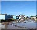
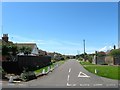
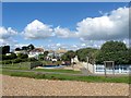
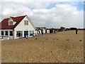
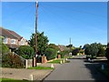
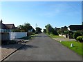
Living in BN12 5ES within Ferring means residing in a small residential cluster defined by ancient origins and a distinct coastal character. This specific postcode covers an area of 897 square metres, housing a population of 1,553 people. The location lies on the A259 road in the Arun District of West Sussex, blending rural farming heritage with the built-up area of Worthing. Residents enjoy a settlement that feels historically grounded, featuring a Norman parish church dedicated to St Andrew and remnants of Bronze Age forts on nearby Highdown Hill. The village grew from a small farming community into a larger settlement with holiday homes appearing from the 1920s onwards. Today, the area maintains an ancient, small-scale settlement feel while functioning as part of a larger suburban footprint. You will find historic bridges and manor farmhouses interspersed among modern developments. The environment offers a peaceful setting away from heavy traffic, yet remains accessible to major cities. This unique mix of Saxon history and contemporary suburban living defines the daily experience for anyone considering homes in this distinctive postcode sector.
- Area Type
- Postcode
- Area Size
- 897 m²
- Population
- Not available
- Population Density
- Not available
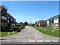
The property market in BN12 5ES is characterised by a stock dominated by houses and long-term resident ownership. With 88% home ownership, the area is overwhelmingly an owner-occupied community rather than a rental market. This high percentage signals that most properties are suited to families or retirees established in the location. The predominant accommodation type is houses, which aligns with the rural-to-suburban character of Ferring. As a small residential cluster covering 897 square metres and housing 1,553 people, supply is naturally limited compared to larger urban districts. Prospective buyers looking for homes in this postcode should expect to compete with others seeking permanent, owner-led residences. The market is not driven by transient student housing or short-term lets, which contributes to property value stability. When viewing properties, you will find predominantly traditional housing styles rather than modern construction blocks. The combination of high ownership and a house-based stock makes this area attractive for those seeking permanence over investment flip opportunities. Understanding these structural facts helps clarify that vendors here are typically living in the homes they sell.
House Prices in BN12 5ES
Showing 1 properties
| Address | Type | Beds | Baths | Last Sale Price | Last Sale Date | |
|---|---|---|---|---|---|---|
| 80 Sea Lane, Ferring, BN12 5ES | Bungalow | - | - | - | - |
Energy Efficiency in BN12 5ES
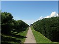
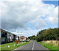
Your daily lifestyle in BN12 5ES benefits from a compact array of amenities located within practical reach. Residents have access to five retail outlets, including notable venues such as The Southern Co-operative Co, Tesco Goring, and Sainsburys Goring. These shopping options provide essential groceries and household essentials without the need for extensive travel. For travel requirements, the area connects to five nearby railway stations, specifically Goring, Durrington, and Angmering Railway Station. These rail links offer onward connections from the village of Ferring to central London and other major cities. While the immediate surroundings may feel quiet and rural, these nearby services ensure you stay connected to the wider region. There are no large leisure parks or nightlife hubs on-site, so evening activities likely centre on home life or nearby coastal walks. The character of the area is shaped by these functional amenities rather than vibrant commercial districts. You will find that daily conveniences are just a short drive or bus ride away, balancing the tranquility of village life with necessary accessibility.
Amenities
Schools
| Rank | School | Type | Entry gender | Ages |
|---|
Explore more schools in this area
Go to Schools tabDemographics
The community in BN12 5ES is defined by an exceptionally mature population profile. The median age stands at 70 years, with the elderly demographic (65+ years) constituting the most common age range. This indicates a neighbourhood where retirement and later life stages are central to the social fabric. Home ownership rates are significantly high, with 88% of residents owning their properties outright or with a mortgage. This figure suggests stability and long-term settlement within the cluster. Most accommodation consists of houses, reflecting a preference for single-family living over flats or terraced homes. The predominant ethnic group is White, consistent with the broader demographic trends of the South East coast. Because of the high ownership rate and older age profile, the area likely prioritises quiet streets and low-traffic environments. For buyers, this demographic creates a calm atmosphere where neighbours have lived in their homes for decades. The concentration of older residents also means local services and amenities often cater to those with specific needs for accessibility and comfort.
Household Size
Accommodation Type
Tenure
Ethnic Group
Religion
Household Composition
Age
Household Deprivation
NS-SEC
Explore more demographic insights in this area
Go to Demographics tabPlanning
Planning Constraints
- Flood RiskPremium
- Ramsar Wetland SitesPremium
- Area of Outstanding Natural BeautyPremium
- Protected Nature ReservePremium
- Protected WoodlandPremium