Area Overview for BN12 5DS
Photos of BN12 5DS

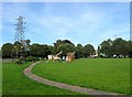
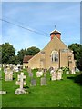

100 photos from this area
Area Information
Key information about the BN12 5DS including its size, population, and administrative classification.
- Area Type
- Postcode
- Area Size
- 7104 m²
- Population
- Not available
- Population Density
- Not available
House Prices in BN12 5DS
10
Properties
£389,716
Average Sold Price
£83,750
Lowest Price
£720,000
Highest Price
Showing 10 properties
| Address | Type | Beds | Baths | Last Sale Price | Last Sale Date | |
|---|---|---|---|---|---|---|
| 10 Sea Lane, Ferring, BN12 5DS | Detached | 4 | - | £720,000 | Feb 2024 | |
| 18 Sea Lane, Ferring, BN12 5DS | Bungalow | - | - | £550,000 | Sep 2021 | |
| 20 Sea Lane, Ferring, BN12 5DS | Bungalow | - | - | £673,477 | May 2021 | |
| Red Tiles, 2A Sea Lane, Ferring, BN12 5DS | Detached | 3 | - | £412,000 | Oct 2019 | |
| 14 Sea Lane, Ferring, BN12 5DS | Bungalow | - | - | £412,500 | Aug 2016 | |
| Kinvara, 6 Sea Lane, Ferring, BN12 5DS | Detached | - | - | £150,000 | Nov 2000 | |
| 2 Sea Lane, Ferring, BN12 5DS | Bungalow | 2 | 2 | £116,000 | Jun 1998 | |
| 4 Sea Lane, Ferring, BN12 5DS | Bungalow | 2 | 2 | £83,750 | Apr 1995 | |
| 4A Sea Lane, Ferring, BN12 5DS | Bungalow | 2 | 2 | - | - | |
| 16 Sea Lane, Ferring, BN12 5DS | Detached | - | - | - | - |
Energy Efficiency in BN12 5DS
Amenities
Schools
| Rank | School | Type | Entry gender | Ages |
|---|
Explore more schools in this area
Go to Schools tabDemographics
Household Size
Two person
most common
Accommodation Type
Houses
most common
Tenure
89
majority
Ethnic Group
White
most common
Religion
N/A
most common
Household Composition
N/A
most common
Age
70
median
Elderly (65+ years)
most common
Household Deprivation
N/A
with no deprivation
NS-SEC
40
in Lower managerial occupations
Explore more demographic insights in this area
Go to Demographics tabPlanning
Planning Constraints
- Flood RiskPremium
- Ramsar Wetland SitesPremium
- Area of Outstanding Natural BeautyPremium
- Protected Nature ReservePremium
- Protected WoodlandPremium