Area Overview for BN12 5DG
Photos of BN12 5DG
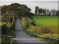
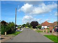
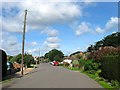
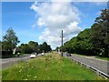
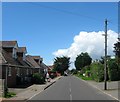
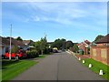
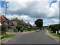
78 photos from this area
Area Information
Key information about the BN12 5DG including its size, population, and administrative classification.
- Area Type
- Postcode
- Area Size
- 2.1 hectares
- Population
- Not available
- Population Density
- Not available
House Prices in BN12 5DG
30
Properties
£367,287
Average Sold Price
£195,000
Lowest Price
£680,000
Highest Price
Showing 30 properties
| Address | Type | Beds | Baths | Last Sale Price | Last Sale Date | |
|---|---|---|---|---|---|---|
| 34 Singleton Crescent, Ferring, BN12 5DG | Bungalow | 2 | 2 | £615,000 | Aug 2024 | |
| 40 Singleton Crescent, Ferring, BN12 5DG | Bungalow | 2 | 1 | £485,000 | Mar 2024 | |
| 43 Singleton Crescent, Ferring, BN12 5DG | Bungalow | 3 | 1 | £595,000 | Jan 2024 | |
| 22 Singleton Crescent, Ferring, BN12 5DG | Bungalow | 3 | 3 | £680,000 | Jul 2023 | |
| 53 Singleton Crescent, Ferring, BN12 5DG | Bungalow | 2 | 1 | £595,000 | Mar 2023 | |
| 55 Singleton Crescent, Ferring, BN12 5DG | Detached | - | - | £400,000 | Oct 2022 | |
| 61 Singleton Crescent, Ferring, BN12 5DG | Retail | 2 | 1 | £475,000 | Feb 2022 | |
| 67 Singleton Crescent, Ferring, BN12 5DG | Bungalow | - | - | £480,000 | Sep 2021 | |
| 69 Singleton Crescent, Ferring, BN12 5DG | Bungalow | 2 | 1 | £377,000 | Jul 2019 | |
| 18 Singleton Crescent, Ferring, BN12 5DG | Bungalow | 2 | 1 | £369,000 | Dec 2018 |
Page 1 of 3
Energy Efficiency in BN12 5DG
Amenities
Schools
| Rank | School | Type | Entry gender | Ages |
|---|
Explore more schools in this area
Go to Schools tabDemographics
Household Size
Two person
most common
Accommodation Type
Houses
most common
Tenure
89
majority
Ethnic Group
White
most common
Religion
N/A
most common
Household Composition
N/A
most common
Age
70
median
Elderly (65+ years)
most common
Household Deprivation
N/A
with no deprivation
NS-SEC
40
in Lower managerial occupations
Explore more demographic insights in this area
Go to Demographics tabPlanning
Planning Constraints
- Flood RiskPremium
- Ramsar Wetland SitesPremium
- Area of Outstanding Natural BeautyPremium
- Protected Nature ReservePremium
- Protected WoodlandPremium