Area Overview for BN12 4ZX
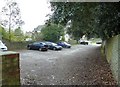
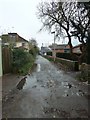
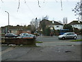
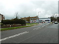
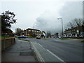
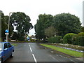
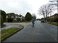
Photos of BN12 4ZX

Area Information
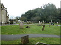
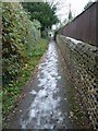
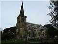
Living in BN12 4ZX, part of Goring-by-Sea in West Sussex, offers a blend of coastal charm and suburban convenience. This small residential cluster lies approximately 2.5 miles west of Worthing town centre, with a mixed pebble and sand beach ideal for watersports like kitesurfing. The area’s character is defined by its garden city-style estates, such as the pre-1939 Goring Hall estate, and the protected Goring Gap, which preserves open fields and woodland. Historically rooted, Goring-by-Sea was first mentioned in the Domesday Book and has evolved into a sought-after location with good transport links and proximity to both countryside and coastal amenities. With a population of 1,789, the community is compact yet connected, featuring notable landmarks like St Mary’s Church and the Bull’s Head pub. Residents benefit from nearby railway stations, including Goring-by-Sea and Durrington-on-Sea, which provide access to Brighton, London, and beyond. The area’s appeal lies in its balance of tranquillity, accessibility, and coastal lifestyle, making it attractive to those seeking a stable, family-oriented environment.
- Area Type
- Postcode
- Area Size
- Not available
- Population
- Not available
- Population Density
- Not available
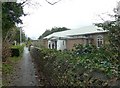
The property market in BN12 4ZX is characterised by a 59% home ownership rate, with houses being the primary accommodation type. This suggests a predominantly owner-occupied area, though the remaining 41% may include rental properties or second homes. The presence of garden city-style estates, such as the Goring Hall estate, indicates a mix of older, established homes and post-war developments. Given the area’s small size and proximity to coastal and rural amenities, properties here likely cater to buyers seeking a balance of space, security, and access to natural landscapes. The limited number of homes means the market is not expansive, but the demand for suburban living near a beach and good transport links may keep prices stable. Buyers should consider the area’s small footprint and the potential for limited new developments, as the housing stock is largely fixed. The focus on houses rather than apartments also appeals to those prioritising private outdoor space.
House Prices in BN12 4ZX
No properties found in this postcode.
Energy Efficiency in BN12 4ZX
The lifestyle in BN12 4ZX is enriched by nearby amenities that cater to daily needs and leisure. Retail options include Sainsburys Goring, Tesco Goring, and Co-op Field, providing essential shopping within easy reach. The area’s proximity to railway stations, including Goring-by-Sea and Durrington-on-Sea, ensures convenient commuting to larger towns and cities. For travel, Shoreham Airport and Shoreham Brighton City Airport offer regional flight connections. The coastal location grants access to a mixed beach, ideal for watersports, while the Goring Gap protected area offers walking and nature opportunities. The Bull’s Head pub and St Mary’s Church add to the area’s character, blending historical charm with modern convenience. These amenities create a lifestyle that balances practicality with the appeal of a coastal suburb, supporting both active and relaxed living.
Amenities
Schools
The nearest school to BN12 4ZX is Goring-By-Sea CofE (Aided) Primary School, which provides education for younger children and holds an Ofsted rating of ‘good’. This school serves the immediate community, offering a foundation for local families. However, no secondary schools are listed in the data, meaning parents may need to look beyond the area for secondary education. The presence of a primary school with a strong rating is a positive for families prioritising early education, though the absence of nearby secondary schools could be a consideration for those planning long-term schooling. The school’s ‘good’ rating suggests a reliable standard of teaching and facilities, though specific details on curriculum or extracurriculars are not provided. Overall, the area supports primary education needs but may require additional planning for older children.
| Rank | School | Type | Entry gender | Ages |
|---|
Explore more schools in this area
Go to Schools tabDemographics
BN12 4ZX has a median age of 47, with the majority of residents falling within the 30-64 age range. This suggests a mature, established community, likely with a strong presence of families and professionals. Home ownership stands at 59%, indicating a mix of owner-occupied properties and rental units, though the exact proportion of renters is not specified. The primary accommodation type is houses, reflecting a suburban layout with larger properties rather than apartments or flats. The predominant ethnic group is White, though specific data on other groups is absent. With a population of 1,789, the area is small enough to foster a close-knit community yet connected to larger regional networks. The age profile and home ownership rate suggest a stable, long-term resident base, with fewer transient populations. This demographic structure supports a quiet, family-friendly atmosphere, though the lack of detailed diversity data means the community’s full composition remains partially unexplored.
Household Size
Accommodation Type
Tenure
Ethnic Group
Religion
Household Composition
Age
Household Deprivation
NS-SEC
Explore more demographic insights in this area
Go to Demographics tabPlanning
Planning Constraints
- Flood RiskPremium
- Ramsar Wetland SitesPremium
- Area of Outstanding Natural BeautyPremium
- Protected Nature ReservePremium
- Protected WoodlandPremium