Area Overview for BN12 4LF
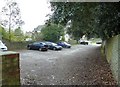
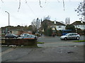
Photos of BN12 4LF
Area Information
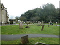
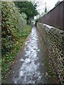
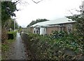
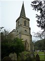
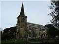
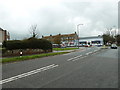
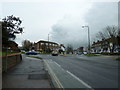
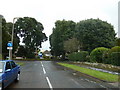
BN12 4LF lies within Goring Ward, a coastal suburb west of West Worthing in West Sussex. With a population of 1,648, it is a small, tightly knit residential cluster characterised by suburban charm and proximity to the sea. The area features a mix of garden-style housing, including the historic Goring Hall estate, and is framed by the Goring Gap protected area, offering access to countryside and coastal walks. Its location, approximately 4 km west of Worthing town centre, provides a balance of seaside appeal and suburban convenience. The A259 motorway runs through the area, linking to Brighton, Littlehampton, and beyond, while railway stations at Goring-by-Sea and Durrington-on-Sea offer regular services to major cities. This postcode is ideal for those seeking a quiet, established community with easy access to both urban amenities and natural landscapes. The area’s history, dating back to the Domesday Book, adds to its character, with landmarks like St Mary’s Church and The Bull’s Head pub anchoring its identity.
- Area Type
- Postcode
- Area Size
- Not available
- Population
- 1648
- Population Density
- 2891 people/km²
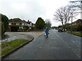
BN12 4LF is predominantly an owner-occupied area, with 87% of homes owned by residents rather than rented. The accommodation type is largely houses, which aligns with the suburban, garden-style character of the postcode. This suggests a market dominated by family homes and detached properties, rather than apartments or flats. Given the small size of the area and its focus on houses, buyers may find limited options within BN12 4LF itself, necessitating consideration of nearby postcodes for more choices. The high home ownership rate indicates a stable market with long-term residents, which can affect property values and availability. For those seeking a traditional, low-density living environment, this area offers a strong case, though competition for existing properties may be fierce.
House Prices in BN12 4LF
No properties found in this postcode.
Energy Efficiency in BN12 4LF
Living in BN12 4LF offers a blend of suburban comfort and coastal access. Within practical reach are shops like Sainsburys Goring, Co-op Field, and Morrisons Daily Goring-by, providing essential retail and grocery needs. The area’s proximity to Goring-by-Sea’s pebble and sand beach supports watersports like kitesurfing, while the Goring Gap protected area offers walking and cycling routes. Nearby, the historic St Mary’s Church and The Bull’s Head pub add to the local character. Rail stations at Durrington, Goring, and West Worthing connect residents to broader networks, ensuring easy access to urban amenities. This postcode combines the convenience of local services with the tranquillity of protected natural spaces, creating a lifestyle that balances daily practicality with recreational opportunities.
Amenities
Schools
| Rank | School | Type | Entry gender | Ages |
|---|
Explore more schools in this area
Go to Schools tabDemographics
The population of BN12 4LF has a median age of 47, with the elderly (65+ years) forming the most common age group. This suggests a mature, settled community, likely with a high proportion of long-term residents. Home ownership is exceptionally high at 87%, indicating a stable housing market with few rental properties. The predominant accommodation type is houses, reflecting a preference for family homes over flats. The predominant ethnic group is White, with no data provided on other demographics. The age profile and ownership figures imply a low turnover of properties, which can influence local services and amenities. For buyers, this means a community with established infrastructure and a focus on long-term residency, though it may also mean limited availability of newer properties.
Household Size
Accommodation Type
Tenure
Ethnic Group
Religion
Household Composition
Age
Household Deprivation
NS-SEC
Explore more demographic insights in this area
Go to Demographics tabPlanning
Planning Constraints
- Flood RiskPremium
- Ramsar Wetland SitesPremium
- Area of Outstanding Natural BeautyPremium
- Protected Nature ReservePremium
- Protected WoodlandPremium