Area Overview for BN12 4DG
Photos of BN12 4DG
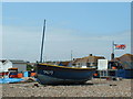
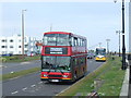
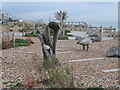
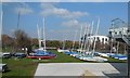

86 photos from this area
Area Information
Key information about the BN12 4DG including its size, population, and administrative classification.
- Area Type
- Postcode
- Area Size
- 7.1 hectares
- Population
- 1648
- Population Density
- 2891 people/km²
House Prices in BN12 4DG
4
Properties
-
Average Sold Price
-
Lowest Price
-
Highest Price
Showing 4 properties
| Address | Type | Beds | Baths | Last Sale Price | Last Sale Date | |
|---|---|---|---|---|---|---|
| Short Sea Outfall Pipeline Adjacent, Sea Place, Marine, Worthing, BN12 4DG | Industrial | - | - | - | - | |
| Flat, Former 14, Sea Place, Marine, Worthing, BN12 4DG | Flat | - | - | - | - | |
| Worthing Yacht Club Boat Compound, Sea Place, Marine, Worthing, BN12 4DG | warehouse | - | - | - | - | |
| Beach Hut 216C Private, Marine Crescent, Goring, Worthing, BN12 4DG | Leisure | - | - | - | - |
Energy Efficiency in BN12 4DG
Amenities
Schools
| Rank | School | Type | Entry gender | Ages |
|---|
Explore more schools in this area
Go to Schools tabDemographics
Household Size
Two person
most common
Accommodation Type
Houses
most common
Tenure
87
majority
Ethnic Group
White
most common
Religion
N/A
most common
Household Composition
N/A
most common
Age
47
median
Elderly (65+ years)
most common
Household Deprivation
N/A
with no deprivation
NS-SEC
42
in Lower managerial occupations
Explore more demographic insights in this area
Go to Demographics tabPlanning
Planning Constraints
- Flood RiskPremium
- Ramsar Wetland SitesPremium
- Area of Outstanding Natural BeautyPremium
- Protected Nature ReservePremium
- Protected WoodlandPremium