Area Overview for BN11 4SZ
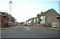
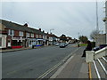
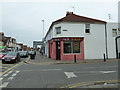
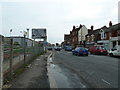
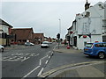
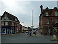
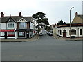
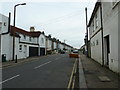
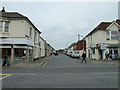
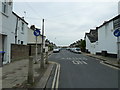
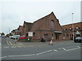
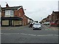
Photos of BN11 4SZ
Area Information
BN11 4SZ is a small residential postcode area in the Worthing Borough Council, home to 1,586 residents. Situated in the South East of England, it is part of the Marine district, a well-defined ward with a compact footprint. The area is characterised by a mature population, with a median age of 47 and a majority of residents aged between 30 and 64. This suggests a stable community, likely composed of long-term residents and families. The area’s housing stock is predominantly flats, reflecting a mix of owner-occupied and rental properties. With 73% of homes owned by residents, it balances private ownership with some rental availability. Daily life here is shaped by proximity to local amenities, including rail stations and retail outlets, while the low crime risk score of 77 ensures a sense of security. The area’s small size means it is tightly integrated with nearby towns, offering convenience without the sprawl of larger urban centres. For those seeking a quiet yet connected neighbourhood, BN11 4SZ provides a blend of practicality and community focus.
- Area Type
- Postcode
- Area Size
- Not available
- Population
- Not available
- Population Density
- Not available
The property market in BN11 4SZ is defined by a high rate of home ownership (73%) and a prevalence of flats. This suggests a community where many residents have long-term ties to the area, with limited turnover in the housing stock. The dominance of flats indicates a focus on smaller, more manageable properties, likely catering to families or individuals seeking convenience over space. While the data does not specify rental availability, the combination of owner-occupation and flat-based housing implies a mix of private buyers and renters. For prospective buyers, this small area offers a niche market with limited new developments, making properties here potentially valuable for investment or long-term residence. However, the compact nature of the postcode means that buyers should consider nearby areas for broader options. The stability of the market, coupled with low crime risk, may appeal to those prioritising security and established living conditions.
House Prices in BN11 4SZ
No properties found in this postcode.
Energy Efficiency in BN11 4SZ
Living in BN11 4SZ offers access to a range of local amenities that support daily life. Retail options include Co-op South, Co-op Worthing, and Iceland West, providing essentials and convenience for households. The area’s rail network is well-served, with five stations nearby, including West Worthing and Durrington, which connect residents to nearby towns and cities. Two airports—Shoreham and Shoreham Brighton City—are within practical reach, offering travel flexibility for those who need it. While the area is small, its proximity to larger centres means residents can access more extensive leisure and cultural facilities beyond the immediate postcode. The presence of multiple retail outlets and transport links contributes to a lifestyle that balances local convenience with regional accessibility, making it suitable for those who value both autonomy and connection to broader networks.
Amenities
Schools
| Rank | School | Type | Entry gender | Ages |
|---|
Explore more schools in this area
Go to Schools tabDemographics
The population of BN11 4SZ is 1,586, with a median age of 47, indicating a mature demographic. The majority of residents fall within the 30-64 age range, suggesting a community of working-age adults and families. Home ownership is high, with 73% of properties owned by residents, reflecting a stable housing market. The area is predominantly occupied by flats, a common feature in smaller residential clusters. The predominant ethnic group is White, though no specific diversity statistics are provided. This demographic profile implies a community with established roots and a focus on long-term living. The absence of detailed deprivation data means it is not possible to assess socioeconomic challenges directly, but the high home ownership rate suggests relative financial stability. The area’s compact size and mature population contribute to a cohesive, low-turnover environment, where familiarity and routine are key aspects of daily life.
Household Size
Accommodation Type
Tenure
Ethnic Group
Religion
Household Composition
Age
Household Deprivation
NS-SEC
Explore more demographic insights in this area
Go to Demographics tabPlanning
Planning Constraints
- Flood RiskPremium
- Ramsar Wetland SitesPremium
- Area of Outstanding Natural BeautyPremium
- Protected Nature ReservePremium
- Protected WoodlandPremium