Area Overview for BN11 3WQ
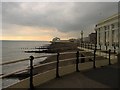
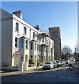
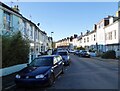
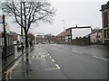
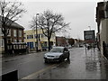
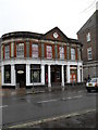
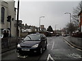
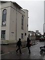
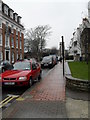
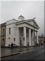
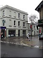
Photos of BN11 3WQ

Area Information
BN11 3WQ lies in the West Worthing area of Worthing borough, a small residential cluster just 0.6 miles west of the town centre along the A259 road. With a population of 1,735, it retains a historic village atmosphere while integrating into the broader suburban fabric of Worthing. The area’s name derives from Old English, reflecting its long-standing roots as a civil parish until 1902. Today, it balances heritage with modern living, featuring landmarks like Heene Cemetery (opened 1873) and St Botolph’s Church. Its proximity to the coast and rail networks makes it a practical choice for commuters, while its compact size fosters a tight-knit community. The area’s mix of residential flats and historic architecture offers a unique blend of convenience and character, appealing to those seeking a quieter life near a bustling town.
- Area Type
- Postcode
- Area Size
- Not available
- Population
- Not available
- Population Density
- Not available
The property market in BN11 3WQ is characterised by a low home ownership rate (32%) and a prevalence of flats. This suggests the area is more rental-oriented than owner-occupied, potentially limiting availability for buyers seeking larger properties. The flat-dominated stock may appeal to those prioritising affordability or ease of maintenance, but it also means competition for limited housing. Given the postcode’s small size, property choices are constrained, and buyers should consider proximity to nearby amenities like rail links and retail hubs. The lack of specific data on property prices or development plans means the market remains opaque, requiring local expertise to navigate effectively.
House Prices in BN11 3WQ
No properties found in this postcode.
Energy Efficiency in BN11 3WQ
BN11 3WQ offers a practical mix of retail, transport, and leisure options within reach. Local shops include Spar, Morrisons Daily Worthing 62–66, and Co-op Plaza, catering to everyday needs. Rail stations like Worthing and West Worthing provide access to wider networks, while nearby airports offer regional travel links. The area’s historic character is complemented by sites like Heene Cemetery and St Botolph’s Church, which add cultural depth. Though limited in scale, these amenities support a convenient lifestyle, blending suburban comfort with access to urban resources. The compact layout ensures residents can reach essentials quickly, though larger retail or entertainment options may require venturing into Worthing’s town centre.
Amenities
Schools
The nearest school to BN11 3WQ is The Education Centre, a special school catering to students with specific educational needs. No Ofsted rating is provided, so prospective families should investigate further for current performance metrics. The presence of a special school indicates the area may attract residents seeking tailored educational provisions, though it lacks mainstream primary or secondary schools. Families requiring a broader range of schooling options may need to look beyond BN11 3WQ, considering nearby towns or private institutions. The school’s role in the community is likely significant, but its singular focus means it does not serve all educational needs.
| Rank | School | Type | Entry gender | Ages |
|---|
Explore more schools in this area
Go to Schools tabDemographics
BN11 3WQ’s population skews towards adults aged 30–64, with a median age of 47. This suggests a mature, settled community, likely with established careers and families. Only 32% of residents own their homes, indicating a rental-heavy market, which may reflect the area’s status as a smaller, secondary residential zone. The predominant accommodation type is flats, a common feature in post-war housing developments. The White ethnic group constitutes the majority, with no data on other demographics. This age profile and home ownership rate imply a community focused on stability rather than rapid growth. The absence of specific deprivation data means quality of life is inferred from amenities and safety assessments, which include a high crime risk.
Household Size
Accommodation Type
Tenure
Ethnic Group
Religion
Household Composition
Age
Household Deprivation
NS-SEC
Explore more demographic insights in this area
Go to Demographics tabPlanning
Planning Constraints
- Flood RiskPremium
- Ramsar Wetland SitesPremium
- Area of Outstanding Natural BeautyPremium
- Protected Nature ReservePremium
- Protected WoodlandPremium