Area Overview for BN11 3LE
Photos of BN11 3LE
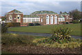
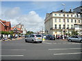
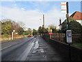
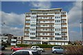


95 photos from this area
Area Information
Key information about the BN11 3LE including its size, population, and administrative classification.
- Area Type
- Postcode
- Area Size
- 1.3 hectares
- Population
- 1815
- Population Density
- 8183 people/km²
House Prices in BN11 3LE
67
Properties
£312,299
Average Sold Price
£106,250
Lowest Price
£680,000
Highest Price
Showing 67 properties
| Address | Type | Beds | Baths | Last Sale Price | Last Sale Date | |
|---|---|---|---|---|---|---|
| 134 Rowlands Road, Heene, Worthing, BN11 3LE | Semi-detached | 4 | - | £680,000 | Oct 2021 | |
| 136 Rowlands Road, Heene, Worthing, BN11 3LE | house | - | - | £610,000 | Jun 2021 | |
| 114 Rowlands Road, Heene, Worthing, BN11 3LE | house | - | - | £380,000 | Jan 2021 | |
| 143 Rowlands Road, Heene, Worthing, BN11 3LE | Semi-detached | 4 | 1 | £488,000 | Jan 2021 | |
| 104 Rowlands Road, Heene, Worthing, BN11 3LE | Terraced | 3 | - | £364,223 | Mar 2020 | |
| 86 Rowlands Road, Heene, Worthing, BN11 3LE | Unknown | - | - | £188,500 | Apr 2017 | |
| 110 Rowlands Road, Heene, Worthing, BN11 3LE | house | - | - | £300,000 | May 2015 | |
| 98 Rowlands Road, Heene, Worthing, BN11 3LE | house | - | - | £367,500 | Aug 2014 | |
| 100 Rowlands Road, Heene, Worthing, BN11 3LE | house | 4 | - | £305,000 | Mar 2010 | |
| 112 Rowlands Road, Heene, Worthing, BN11 3LE | house | - | - | £230,000 | Sep 2009 |
Page 1 of 7
Energy Efficiency in BN11 3LE
Amenities
Schools
| Rank | School | Type | Entry gender | Ages |
|---|
Explore more schools in this area
Go to Schools tabDemographics
Household Size
One person
most common
Accommodation Type
Flats
most common
Tenure
60
majority
Ethnic Group
White
most common
Religion
N/A
most common
Household Composition
N/A
most common
Age
47
median
Adults (30-64 years)
most common
Household Deprivation
N/A
with no deprivation
NS-SEC
38
in Lower managerial occupations
Explore more demographic insights in this area
Go to Demographics tabPlanning
Planning Constraints
- Flood RiskPremium
- Ramsar Wetland SitesPremium
- Area of Outstanding Natural BeautyPremium
- Protected Nature ReservePremium
- Protected WoodlandPremium