Area Overview for BN11 3EY
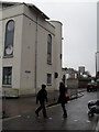
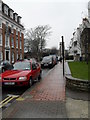
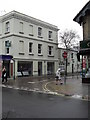
Photos of BN11 3EY


Area Information
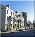
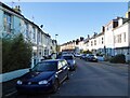
BN11 3EY is a small residential postcode cluster in the coastal town of Worthing, West Sussex. With a population of just 1,207, it reflects the compact, established character of a mature urban area. Situated in the Central Ward, it forms part of the Worthing West parliamentary constituency, nestled within a town known for its seaside charm and commuter accessibility. Daily life here is shaped by its proximity to Worthing’s amenities, including retail hubs and rail links. The area’s demographic profile—primarily adults aged 30–64—suggests a community rooted in stability, with many residents likely working in nearby towns or commuting to London. While the postcode covers a limited physical area, its integration with Worthing’s infrastructure means residents benefit from coastal living without sacrificing connectivity. The low flood risk and absence of environmental constraints further underline its practical appeal. However, the high crime risk score, though not an immediate threat, necessitates awareness of local safety measures. For buyers seeking a quiet, established residential spot with access to town amenities, BN11 3EY offers a blend of coastal charm and urban convenience.
- Area Type
- Postcode
- Area Size
- Not available
- Population
- Not available
- Population Density
- Not available
The property market in BN11 3EY is defined by its low home ownership rate—only 32% of properties are owner-occupied—suggesting a strong rental presence. The accommodation type is predominantly flats, which is typical for smaller, urban postcode areas with limited land for detached housing. This configuration may appeal to buyers seeking low-maintenance, centrally located properties, though the high proportion of rentals could indicate a transient population. The area’s average new-build sale price, estimated at £277,032 between 2017–2020, positions it in the mid-range for Worthing’s wards, reflecting a balance between coastal desirability and practical urban living. For buyers, this means properties are likely to be compact but functional, with potential for long-term value if demand for rental properties remains steady. However, the small size of the postcode means the immediate surroundings—such as nearby wards—may offer more variety in housing stock.
House Prices in BN11 3EY
No properties found in this postcode.
Energy Efficiency in BN11 3EY
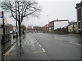
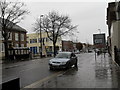
Living in BN11 3EY offers access to a range of amenities within easy reach. The retail sector is well-served by major chains such as Tesco Worthing, Iceland Worthing, and M&S Worthing, providing everyday shopping convenience. For commuters, the area’s rail network is a key asset, with five stations—including Worthing Railway Station—offering connections to London, Brighton, and other regional hubs. Air travel is also accessible via Shoreham Airport and Shoreham Brighton City Airport, which cater to both domestic and international routes. While the area lacks large parks or green spaces, its proximity to Worthing’s coastal areas and urban amenities ensures a balance between convenience and outdoor options. The presence of multiple retail and transport hubs suggests a lifestyle focused on accessibility and practicality, appealing to those who value ease of movement over expansive natural surroundings.
Amenities
Schools
| Rank | School | Type | Entry gender | Ages |
|---|
Explore more schools in this area
Go to Schools tabDemographics
BN11 3EY’s population of 1,207 is predominantly composed of adults aged 30–64, reflecting a mature community with a median age of 47. This age range suggests a mix of professionals, families, and retirees, though the absence of data on children or younger residents implies limited family-oriented demographics. Home ownership here is relatively low, with only 32% of properties owned by residents, indicating a rental-heavy market. The accommodation type is largely flats, which aligns with the area’s compact nature and likely density of housing. The predominant ethnic group is White, though no specific diversity metrics are provided. The lack of data on deprivation or income levels means quality of life factors such as access to services or social mobility cannot be assessed here. However, the age profile and property type suggest a stable, possibly middle-income community seeking convenience over space. Residents may prioritize proximity to amenities over expansive living areas, a trend common in established urban wards.
Household Size
Accommodation Type
Tenure
Ethnic Group
Religion
Household Composition
Age
Household Deprivation
NS-SEC
Explore more demographic insights in this area
Go to Demographics tabPlanning
Planning Constraints
- Flood RiskPremium
- Ramsar Wetland SitesPremium
- Area of Outstanding Natural BeautyPremium
- Protected Nature ReservePremium
- Protected WoodlandPremium