Area Overview for BN11 2DP
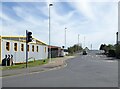
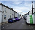
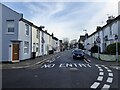
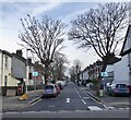
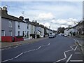
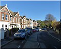
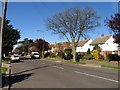
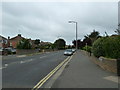
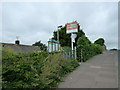
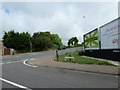
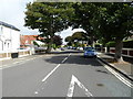
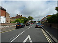
Photos of BN11 2DP
Area Information
BN11 2DP is a small residential cluster in East Worthing, situated immediately east of Worthing town centre. With a population of 1660, it forms part of the Selden electoral ward in West Sussex. The area blends quiet residential living with proximity to urban amenities. Coordinates place it at approximately 50.8151° N, -0.3615° W, positioning it near key transport hubs and local services. Residents benefit from being close to Worthing’s core, yet the area retains a distinct character shaped by its compact size and traditional housing stock. The postcode area is served by multiple rail stations, including East Worthing and West Worthing, offering easy access to regional travel. For families, the presence of primary schools and nearby retail options adds to its appeal. While the community is small, it is well-connected to broader networks, making it a practical choice for those seeking a balance between suburban calm and urban accessibility.
- Area Type
- Postcode
- Area Size
- Not available
- Population
- 1660
- Population Density
- 6710 people/km²
BN11 2DP is predominantly a home-ownership area, with 68% of properties owned by residents rather than rented. The accommodation type is primarily houses, which aligns with the area’s character as a residential cluster rather than a high-density development. This suggests a focus on family homes and single-occupancy properties, which may appeal to buyers seeking traditional housing. Given the small size of the postcode area, the housing stock is limited, meaning buyers may need to consider nearby postcodes for a broader selection. The emphasis on owner-occupation indicates a stable market, with fewer short-term rental properties. For those seeking a home, the availability of houses in a low-crime, well-connected area could be a key selling point, though the compact nature of BN11 2DP means competition for properties may be higher.
House Prices in BN11 2DP
No properties found in this postcode.
Energy Efficiency in BN11 2DP
The lifestyle in BN11 2DP is shaped by its proximity to retail, transport, and leisure options. Nearby shops include Co-op Ham, Budgens MRH, and Tesco Dolphin, providing everyday convenience. The area’s rail stations connect residents to broader networks, while the presence of Shoreham Airport and Shoreham Brighton City Airport adds flexibility for travel. Although the postcode area is small, its integration with East Worthing ensures access to larger amenities. The mix of retail and transport infrastructure supports a practical, accessible lifestyle, ideal for those prioritising ease of movement. While the area lacks major parks or leisure facilities within the postcode itself, its location near Worthing town centre opens up more extensive recreational options. The balance of local shops, transport, and nearby airports makes BN11 2DP a functional choice for residents seeking convenience without sacrificing residential tranquillity.
Amenities
Schools
Residents of BN11 2DP have access to two primary schools: Homefield Primary School, which holds a ‘good’ Ofsted rating, and Lyndhurst First and Middle School. Both institutions cater to younger children, ensuring families have options for early education within the area. The presence of two primary schools suggests a focus on local schooling, reducing the need for long commutes. Homefield’s ‘good’ rating indicates a satisfactory standard of education, though parents may still seek additional information about curriculum or resources. For families prioritising proximity to schools, BN11 2DP offers a practical solution, with both institutions within practical reach. The absence of secondary schools in the immediate area means students may need to travel further, but the rail network provides convenient access to larger towns like Worthing.
| Rank | School | Type | Entry gender | Ages |
|---|
Explore more schools in this area
Go to Schools tabDemographics
The population of BN11 2DP has a median age of 47, with the most common age range being adults aged 30–64 years. This suggests a mature, settled community, likely with a focus on family-oriented living. Home ownership stands at 68%, indicating a strong presence of long-term residents. The predominant accommodation type is houses, reflecting a residential area with a mix of family homes and single-occupancy properties. The predominant ethnic group is White, with no specific data on diversity beyond this. The age profile and ownership rates suggest a stable, low-turnover neighbourhood, where residents may prioritise established housing over rental properties. The absence of detailed deprivation metrics means the area’s quality of life is inferred from its infrastructure and services, such as schools and transport links.
Household Size
Accommodation Type
Tenure
Ethnic Group
Religion
Household Composition
Age
Household Deprivation
NS-SEC
Explore more demographic insights in this area
Go to Demographics tabPlanning
Planning Constraints
- Flood RiskPremium
- Ramsar Wetland SitesPremium
- Area of Outstanding Natural BeautyPremium
- Protected Nature ReservePremium
- Protected WoodlandPremium