Area Overview for BN11 1RF
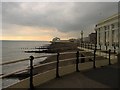
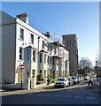
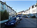
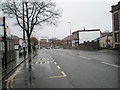
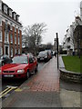
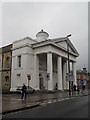
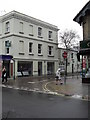
Photos of BN11 1RF

Area Information
BN11 1RF represents a specific postcode cluster within the Central Ward of Worthing, West Sussex. This small residential area spans just 2,035 square metres and holds a population of 2,019 people. Residents live in a compact setting where density is higher than typical rural English villages. The area sits within the Worthing West parliamentary constituency, offering a clear administrative identity for local governance. Living in BN11 1RF means you are part of an established urban ward on the south coast of England. The location benefits from its position within Worthing Borough Council, which frames the broader context of daily life. You will find yourself in a town known for its coastal settlement status while maintaining a distinct residential character. The area does not contain large open spaces, as the total land coverage is quite limited for a community of this size. This compact nature creates a tight-knit environment where neighbours are often close by. The postcode area serves as a functional unit within the wider town infrastructure, connecting directly to council services and transport links. Your daily routine involves navigating this small but connected part of Worthing, where specific boundaries define your immediate neighbourhood.
- Area Type
- Postcode
- Area Size
- 2035 m²
- Population
- Not available
- Population Density
- Not available
The property market in BN11 1RF reflects a specific housing stock profile driven by recent sales data from 1993 to 2020. The average new-build sale price in the surrounding Central Ward reached £277,032 during this period. Prices per square metre averaged £3,767, positioning the area in the mid-range for Worthing wards by property values. This financial data indicates a mixed residential character typical of an established urban ward. Flats remain the primary form of accommodation available for purchase or rent. With home ownership at only 38%, most homes in this cluster change hands frequently within the private rental sector. Buyers looking for properties in BN11 1RF face a market dominated by second-hand transactions and leasehold purchases. The limited land size of 2,035 square metres restricts the availability of large detached houses, favouring smaller dwellings instead. You can expect competition focused on top-floor units or ground-floor apartments rather than standalone family homes. The data shows that buyers are paying a premium for convenience within a compact setting. Market activity here relies heavily on the specific demand for flat living in Worthing. Understanding these price points helps you budget accurately for homes in this postcode.
House Prices in BN11 1RF
Showing 1 properties
| Address | Type | Beds | Baths | Last Sale Price | Last Sale Date | |
|---|---|---|---|---|---|---|
| Qh St Mary's Ltd, St Marys Residential Home, 14 Westbrooke, Worthing Central, Worthing, BN11 1RF | hospital_care_home | - | - | £575,000 | Nov 2019 |
Energy Efficiency in BN11 1RF
Living in BN11 1RF provides convenient access to a range of retail and transport amenities within practical reach. Local shoppers frequent Tesco Worthing, Co-op Plaza, and M&S Worthing for daily needs. These stores form the core of your retail experience without requiring a long journey. For railway travel, you have access to Worthing Railway Station, West Worthing Railway Station, and East Worthing Railway Station. These stations offer broad connectivity across the south coast network. Travelers seeking air access can reach Shoreham Airport and Shoreham Brighton City Airport from this postcode. The proximity of two airports provides flexibility for business trips or leisure travel. Your daily lifestyle integrates these major facilities into a short commute or walk. The availability of national chains like Tesco ensures consistent quality and variety in shopping options. You do not need to travel far to access supermarkets, department stores, or train platforms. This blend of convenience and transport links defines the living experience in BN11 1RF. Residents value the ability to manage errands and travel efficiently from their doorstep.
Amenities
Schools
| Rank | School | Type | Entry gender | Ages |
|---|
Explore more schools in this area
Go to Schools tabDemographics
The community in BN11 1RF displays a clear demographic profile centred on mature residents. The median age of the population is 47 years, indicating a significant shift away from younger families. Most residents fall into the adult age range between 30 and 64 years. This age distribution suggests the area attracts couples, professionals in their prime, and potentially retired individuals seeking a specific lifestyle. Home ownership stands at 38%, leaving the majority of households in the rental market or otherwise not owning their primary residence. Flats form the predominant accommodation type within this postcode. This housing style aligns with the needs of an adult population that may value low-maintenance living over traditional single-family homes. The population bears a predominantly White ethnic composition, marking the demographic majority in this specific cluster. Understanding these figures helps you grasp who currently calls BN11 1RF home. The concentration of older adults influences the local character, from the pace of life to the types of amenities sought nearby. You will be joining a community defined by stability and a specific age cohort rather than a mix of toddlers and teenagers. These statistics provide a grounded view of the social fabric without speculation.
Household Size
Accommodation Type
Tenure
Ethnic Group
Religion
Household Composition
Age
Household Deprivation
NS-SEC
Explore more demographic insights in this area
Go to Demographics tabPlanning
Planning Constraints
- Flood RiskPremium
- Ramsar Wetland SitesPremium
- Area of Outstanding Natural BeautyPremium
- Protected Nature ReservePremium
- Protected WoodlandPremium