Area Overview for BN11 1LT
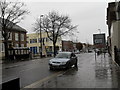
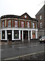
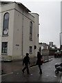
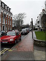
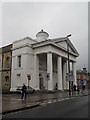
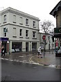
Photos of BN11 1LT


Area Information
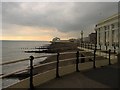
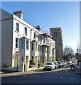
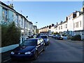
BN11 1LT is a small residential postcode area in Worthing, West Sussex, forming part of the Central Ward. With a population of 2,123, it sits within the coastal town of Worthing, known for its proximity to the English Channel and historic architecture. The area is a compact cluster of homes, typical of established urban wards in coastal towns. Its location offers a blend of residential living and access to nearby amenities, including multiple railway stations and retail hubs. The median age of residents is 47, suggesting a mature community, with most households falling within the 30-64 age range. While the area lacks large-scale developments, its proximity to Worthing’s town centre and transport links makes it a practical choice for those seeking a balance between coastal living and urban convenience. The postcode’s small size means it is tightly integrated with surrounding neighbourhoods, creating a cohesive local identity. For buyers, BN11 1LT represents a slice of Worthing’s mid-range property market, where homes are primarily flats, and ownership rates are moderate.
- Area Type
- Postcode
- Area Size
- Not available
- Population
- Not available
- Population Density
- Not available
BN11 1LT is characterised by a housing stock dominated by flats, with 38% of residents owning their homes. This suggests a rental market with a strong presence of leasehold properties, typical of urban areas with limited space for larger homes. The area’s small size means property options are limited to a few residential clusters, making it a niche market for buyers. The average new-build sale price in the Central Ward, of which BN11 1LT is part, was £277,032 between 2017 and 2020, placing it in the mid-range for Worthing’s wards. This positions the area as neither excessively expensive nor undervalued, appealing to those seeking affordable coastal living. However, the flat-dominated market may limit choices for buyers prioritising larger homes. Prospective buyers should consider the area’s compact nature and its integration with nearby neighbourhoods, which could influence long-term property value trends.
House Prices in BN11 1LT
No properties found in this postcode.
Energy Efficiency in BN11 1LT
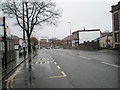
BN11 1LT’s residents have access to a range of amenities within easy reach. The area is near five retail outlets, including major supermarkets like Tesco Worthing, Lidl Central, and Waitrose Worthing, ensuring convenient shopping options. Three railway stations provide direct access to local and regional transport, while two airports cater to those needing air travel. Although the data does not mention parks or leisure facilities, the proximity to Worthing’s town centre likely offers additional recreational opportunities. The availability of essential services and transport links contributes to a practical, convenient lifestyle, ideal for those prioritising accessibility over expansive green spaces.
Amenities
Schools
The nearest school to BN11 1LT is Reflections Small School, an independent institution. No other schools are listed in the data, so families relying on state education may need to look beyond the immediate area. Independent schools often cater to specific educational philosophies or specialisms, which could be a draw for parents seeking tailored schooling. However, the absence of state schools in the data means it is unclear whether the area’s proximity to Worthing’s town centre provides access to other educational institutions. For families prioritising a range of school options, BN11 1LT’s limited local provision may necessitate commuting to nearby wards or towns.
| Rank | School | Type | Entry gender | Ages |
|---|
Explore more schools in this area
Go to Schools tabDemographics
BN11 1LT has a median age of 47, with the majority of residents aged between 30 and 64. This suggests a community of working-age adults, likely established professionals or families. Home ownership in the area stands at 38%, indicating a significant portion of residents rent their homes. The predominant accommodation type is flats, which aligns with the area’s compact nature and limited housing stock. The predominant ethnic group is White, though no specific data on diversity or deprivation is provided. The age profile implies a stable population, with fewer young families or retirees compared to other areas. The 38% home ownership rate suggests a mix of renters and owners, which may influence the local property market dynamics. The absence of specific data on deprivation means it is unclear how economic factors affect quality of life, though the area’s proximity to amenities may mitigate such concerns.
Household Size
Accommodation Type
Tenure
Ethnic Group
Religion
Household Composition
Age
Household Deprivation
NS-SEC
Explore more demographic insights in this area
Go to Demographics tabPlanning
Planning Constraints
- Flood RiskPremium
- Ramsar Wetland SitesPremium
- Area of Outstanding Natural BeautyPremium
- Protected Nature ReservePremium
- Protected WoodlandPremium