Area Overview for BN11 1EW
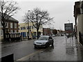
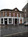
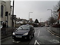
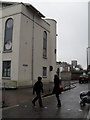
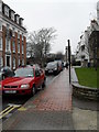
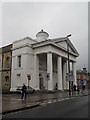
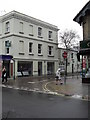
Photos of BN11 1EW

Area Information
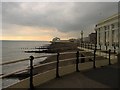
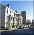
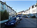
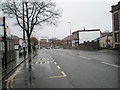
BN11 1EW is a small, densely populated residential postcode area in Worthing, West Sussex. With a population of 1,207 spread across 187 square metres, it is one of the most compact urban clusters in the region. The area falls within the Central Ward, part of the Worthing West parliamentary constituency, and is typical of established coastal towns. Daily life here is shaped by its proximity to Worthing’s town centre, offering a mix of residential tranquillity and access to urban amenities. The ward’s population density—over 6.4 million people per square kilometre—reflects its high concentration of housing, though the area remains a modest, tightly knit community. Residents benefit from proximity to Worthing’s rail network and nearby airports, making it a practical choice for commuters. Despite its size, BN11 1EW is not a standalone town but a microcosm of a coastal town’s character, blending older housing stock with modern infrastructure. Its location in a parliamentary seat with a focus on local governance suggests a community engaged in civic matters. For buyers, it is a niche area where affordability and proximity to services are key considerations.
- Area Type
- Postcode
- Area Size
- 187 m²
- Population
- Not available
- Population Density
- Not available
The property market in BN11 1EW is characterised by a high proportion of rental properties, with only 32% of homes owned by residents. The area’s housing stock is dominated by flats, which are typical in densely populated urban clusters. This suggests a market oriented more towards tenants than buyers, though the small size of the area means that property availability is limited. Historical data from 2017–2020 indicates an average new-build sale price of £277,032, with a price per square metre of £3,767. These figures position BN11 1EW in the mid-range for Worthing’s wards, reflecting its status as an established urban area rather than a newly developed suburb. Buyers considering this area should note the scarcity of available properties and the potential for higher competition. The focus on flats may appeal to those prioritising convenience and affordability over larger homes, though the lack of data on current market trends means recent price movements are unknown.
House Prices in BN11 1EW
No properties found in this postcode.
Energy Efficiency in BN11 1EW
Residents of BN11 1EW have access to a range of nearby amenities that support daily life. The area includes five retail outlets, such as Tesco Worthing, Lidl Central, and Iceland Worthing, providing essential shopping and grocery needs. Three rail stations—Worthing, East Worthing, and West Worthing—offer convenient travel options for commuting or leisure trips. Two airports, Shoreham Airport and Shoreham Brighton City Airport, are within practical reach, though they cater more to regional rather than international travel. The area’s proximity to Worthing’s town centre likely enhances its appeal, offering additional dining, cultural, and recreational opportunities. While the data does not specify parks or leisure facilities, the presence of multiple retail and transport hubs suggests a focus on practicality and connectivity. The combination of retail, rail, and air links makes BN11 1EW a functional choice for those prioritising convenience and accessibility in their daily routines.
Amenities
Schools
| Rank | School | Type | Entry gender | Ages |
|---|
Explore more schools in this area
Go to Schools tabDemographics
BN11 1EW has a median age of 47, with the majority of residents aged between 30 and 64. This suggests a mature, stable population, likely with established careers and families. Home ownership in the area is relatively low at 32%, indicating that a significant portion of the housing stock is rented. The predominant accommodation type is flats, reflecting a focus on high-density living. The predominant ethnic group is White, though the data does not provide further breakdowns on diversity. The age profile and ownership figures imply a community where older residents may be more likely to own property, while younger or transient populations rely on rental housing. The lack of specific data on deprivation means it is unclear whether the area faces socioeconomic challenges, but the high proportion of renters could suggest limited opportunities for property investment. The demographic mix is likely to influence local services and amenities, with a focus on needs such as healthcare, education, and transport for middle-aged residents.
Household Size
Accommodation Type
Tenure
Ethnic Group
Religion
Household Composition
Age
Household Deprivation
NS-SEC
Explore more demographic insights in this area
Go to Demographics tabPlanning
Planning Constraints
- Flood RiskPremium
- Ramsar Wetland SitesPremium
- Area of Outstanding Natural BeautyPremium
- Protected Nature ReservePremium
- Protected WoodlandPremium