Area Overview for BN11 1EF
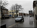
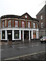
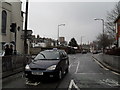
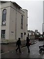
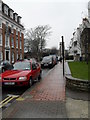
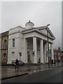
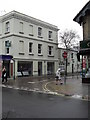
Photos of BN11 1EF

Area Information
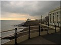
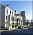
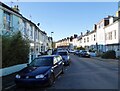
BN11 1EF is a small residential cluster within the coastal town of Worthing, West Sussex. With a population of just 1,207, it reflects the compact, established character of a mature urban ward. The area is part of the Worthing West parliamentary constituency and sits within the Central Ward electoral division. Daily life here is shaped by its proximity to key amenities, including multiple railway stations and retail hubs. The median age of 47 suggests a community of middle-aged adults, many of whom are likely long-term residents. While the area lacks large-scale developments, its compact size offers a sense of familiarity and accessibility. Residents benefit from being near Worthing’s main services, including supermarkets like Tesco and Waitrose, and easy access to rail links that connect to London and Brighton. The postcode’s small footprint means it is well-integrated into the broader town, yet distinct in its residential focus. For buyers, this area represents a blend of practicality and coastal town convenience, though its limited size means it is best suited for those prioritising proximity to amenities over expansive living spaces.
- Area Type
- Postcode
- Area Size
- Not available
- Population
- Not available
- Population Density
- Not available
The property market in BN11 1EF is defined by its low home ownership rate of 32%, indicating that the majority of housing is rented rather than owner-occupied. This suggests a rental-focused market, which may be influenced by the area’s compact size and its role as part of a larger urban ward. The predominant accommodation type is flats, which aligns with the small-scale residential nature of the postcode. For buyers, this means the available housing stock is likely to be limited in size and variety, with a focus on smaller, purpose-built units. The area’s property values are not explicitly stated, but broader data from nearby wards suggests mid-range prices typical of established coastal towns. For those considering purchase, the low home ownership rate may signal a competitive rental market, while the flat-dominated stock could appeal to investors or first-time buyers seeking manageable properties. The area’s proximity to amenities may also make it attractive for those prioritising convenience over expansive living spaces.
House Prices in BN11 1EF
No properties found in this postcode.
Energy Efficiency in BN11 1EF
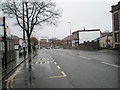
Living in BN11 1EF offers access to a range of practical amenities within close proximity. The area is served by five retail outlets, including major supermarkets like Tesco Worthing, Lidl Central, and Waitrose Worthing, ensuring easy access to groceries and daily essentials. Three railway stations—Worthing, East Worthing, and West Worthing—provide frequent services to key destinations, enhancing mobility for residents. Nearby airports, such as Shoreham Airport and Shoreham Brighton City Airport, cater to those requiring air travel. While the area is small, its integration with Worthing’s broader infrastructure means residents can enjoy the town’s coastal amenities, cultural venues, and leisure opportunities. The presence of multiple retail and transport hubs contributes to a convenient, efficient lifestyle, making BN11 1EF ideal for those prioritising accessibility over expansive living spaces. The compact nature of the postcode ensures that amenities are never far, fostering a practical, community-oriented way of life.
Amenities
Schools
| Rank | School | Type | Entry gender | Ages |
|---|
Explore more schools in this area
Go to Schools tabDemographics
BN11 1EF has a median age of 47, with the majority of residents aged between 30 and 64. This indicates a mature, settled community with a strong presence of middle-aged adults. Home ownership in the area stands at 32%, which is relatively low, suggesting that a significant portion of the housing stock is rented. The predominant accommodation type is flats, reflecting a mix of purpose-built and converted housing. The White ethnic group makes up the majority of the population, though specific data on diversity beyond this is not provided. The age profile and home ownership figures together suggest a community that is stable but not rapidly growing. With 32% of residents owning their homes, the area may appeal to those seeking rental properties or investment opportunities in a compact, well-serviced postcode. The demographic profile also implies a focus on practical living, with residents likely prioritising accessibility to local services over large homes.
Household Size
Accommodation Type
Tenure
Ethnic Group
Religion
Household Composition
Age
Household Deprivation
NS-SEC
Explore more demographic insights in this area
Go to Demographics tabPlanning
Planning Constraints
- Flood RiskPremium
- Ramsar Wetland SitesPremium
- Area of Outstanding Natural BeautyPremium
- Protected Nature ReservePremium
- Protected WoodlandPremium