Area Overview for BN10 8WJ
Photos of BN10 8WJ
Area Information
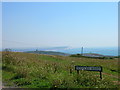
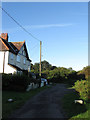
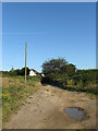
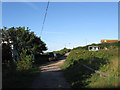
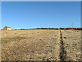
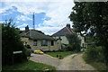
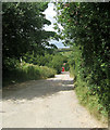
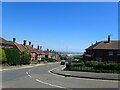
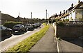
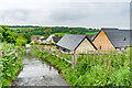
BN10 8WJ lies within the small residential cluster of Peacehaven in East Sussex, a town perched above the chalk cliffs of the South Downs. With a population of 2326 and a density of 1587 people per square kilometre, this area is compact yet rich in character. Its proximity to Brighton—just 10 kilometres west—offers easy access to a major city, while its coastal location near the Greenwich Meridian crossing adds a unique geographical allure. Peacehaven itself was founded in 1916 as a planned town, with its name shifting from a competition-winning tribute to ANZAC soldiers to the more peaceful “Peacehaven” during World War I. Today, the area blends modern living with historical significance, from Bronze Age burial mounds to 20th-century developments. Daily life here is shaped by its small-town charm, with residents enjoying a mix of quiet residential streets and coastal vistas. The area’s density means it is tightly knit, with amenities and transport links within practical reach, making it ideal for those seeking a balance between rural tranquillity and urban connectivity.
- Area Type
- Postcode
- Area Size
- Not available
- Population
- 2326
- Population Density
- 1587 people/km²
The property market in BN10 8WJ is characterised by a high rate of home ownership—67%—and a predominance of houses. This indicates a community where long-term residency is common, with fewer rental properties compared to other areas. The focus on houses suggests a mix of semi-detached and detached homes, typical of small towns in the South Downs. Given the area’s compact size, the housing stock is limited, meaning buyers may need to consider nearby suburbs or towns for more options. The high home ownership rate also implies strong local demand, which could support property values. However, the small size of BN10 8WJ means the market is niche, with limited scope for new developments. For buyers, this translates to a stable but constrained market, where properties are likely to be family homes with established communities.
House Prices in BN10 8WJ
No properties found in this postcode.
Energy Efficiency in BN10 8WJ
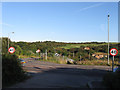
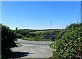
Living in BN10 8WJ offers access to a range of practical amenities within walking or short driving distance. Retail options include Morrisons Daily, Co-op South, and Co-op Fort, providing everyday shopping needs. The area’s rail network is particularly strong, with five stations—Newhaven Harbour, Newhaven Town, Bishopstone, and two others—offering frequent services to Brighton and other regional hubs. This connectivity supports both daily commutes and weekend travel. While the data does not specify parks or leisure facilities, the town’s coastal location and proximity to the South Downs suggest opportunities for outdoor activities. The presence of multiple retail outlets and rail links contributes to a convenient, self-sufficient lifestyle, ideal for those valuing accessibility without sacrificing the charm of a small town.
Amenities
Schools
| Rank | School | Type | Entry gender | Ages |
|---|
Explore more schools in this area
Go to Schools tabDemographics
BN10 8WJ has a median age of 47, with the majority of residents falling within the 30-64 age range. This suggests a community dominated by middle-aged adults, likely including families and professionals. Home ownership is high at 67%, indicating a stable, long-term population with a strong preference for owning property. The predominant accommodation type is houses, reflecting a residential area with larger, private dwellings rather than apartments or flats. The predominant ethnic group is White, though specific data on diversity is not provided. The age profile and home ownership rate suggest a mature, settled community with a focus on family living. The high population density—1587 people per square kilometre—means the area is compact, but the presence of houses implies a mix of single-family homes rather than high-rise living. This demographic profile supports a quiet, stable environment with fewer transient residents.
Household Size
Accommodation Type
Tenure
Ethnic Group
Religion
Household Composition
Age
Household Deprivation
NS-SEC
Explore more demographic insights in this area
Go to Demographics tabPlanning
Planning Constraints
- Flood RiskPremium
- Ramsar Wetland SitesPremium
- Area of Outstanding Natural BeautyPremium
- Protected Nature ReservePremium
- Protected WoodlandPremium