Area Overview for BN10 8JA
Photos of BN10 8JA
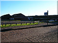
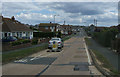
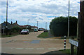

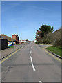

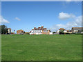
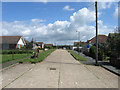
39 photos from this area
Area Information
Key information about the BN10 8JA including its size, population, and administrative classification.
- Area Type
- Postcode
- Area Size
- 1.1 hectares
- Population
- 1164
- Population Density
- 5700 people/km²
House Prices in BN10 8JA
11
Properties
£233,279
Average Sold Price
£83,000
Lowest Price
£429,950
Highest Price
Showing 11 properties
| Address | Type | Beds | Baths | Last Sale Price | Last Sale Date | |
|---|---|---|---|---|---|---|
| 206 Arundel Road Central, Peacehaven, BN10 8JA | Detached | 2 | 1 | £338,500 | Sep 2025 | |
| 175 Arundel Road Central, Peacehaven, BN10 8JA | Bungalow | - | - | £429,950 | Jan 2022 | |
| 202 Arundel Road Central, Peacehaven, BN10 8JA | Bungalow | - | - | £255,000 | Feb 2018 | |
| 212 Arundel Road Central, Peacehaven, BN10 8JA | Detached | - | - | £225,000 | Aug 2017 | |
| 169 Arundel Road Central, Peacehaven, BN10 8JA | Bungalow | - | - | £210,000 | Oct 2009 | |
| 177 Arundel Road Central, Peacehaven, BN10 8JA | Detached | - | - | £91,500 | Aug 1999 | |
| 179 Arundel Road Central, Peacehaven, BN10 8JA | Bungalow | 2 | 1 | £83,000 | Jul 1999 | |
| 210 Arundel Road Central, Peacehaven, BN10 8JA | Semi-detached | 2 | 1 | - | - | |
| 204 Arundel Road Central, Peacehaven, BN10 8JA | Bungalow | - | - | - | - | |
| 202A Arundel Road Central, Peacehaven, BN10 8JA | Bungalow | - | - | - | - |
Page 1 of 2
Energy Efficiency in BN10 8JA
Amenities
Schools
| Rank | School | Type | Entry gender | Ages |
|---|
Explore more schools in this area
Go to Schools tabDemographics
Household Size
One person
most common
Accommodation Type
Flats
most common
Tenure
49
majority
Ethnic Group
White
most common
Religion
N/A
most common
Household Composition
N/A
most common
Age
47
median
Adults (30-64 years)
most common
Household Deprivation
N/A
with no deprivation
NS-SEC
23
in Lower managerial occupations
Explore more demographic insights in this area
Go to Demographics tabPlanning
Planning Constraints
- Flood RiskPremium
- Ramsar Wetland SitesPremium
- Area of Outstanding Natural BeautyPremium
- Protected Nature ReservePremium
- Protected WoodlandPremium