Area Overview for BN10 8HN
Photos of BN10 8HN
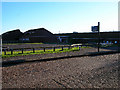
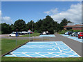
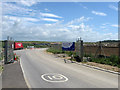
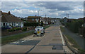
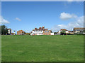
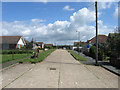
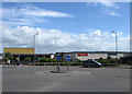
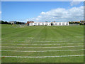
39 photos from this area
Area Information
Key information about the BN10 8HN including its size, population, and administrative classification.
- Area Type
- Postcode
- Area Size
- 1.7 hectares
- Population
- 1980
- Population Density
- 4527 people/km²
House Prices in BN10 8HN
50
Properties
£242,673
Average Sold Price
£50,222
Lowest Price
£375,000
Highest Price
Showing 50 properties
| Address | Type | Beds | Baths | Last Sale Price | Last Sale Date | |
|---|---|---|---|---|---|---|
| 29 Steyning Avenue, Peacehaven, BN10 8HN | Detached | 3 | 1 | £330,000 | Jun 2025 | |
| 26A Steyning Avenue, Peacehaven, BN10 8HN | Bungalow | - | - | £220,000 | Feb 2025 | |
| 36A Steyning Avenue, Peacehaven, BN10 8HN | Bungalow | 1 | 1 | £226,000 | Feb 2024 | |
| 31 Steyning Avenue, Peacehaven, BN10 8HN | Bungalow | - | - | £365,000 | Mar 2023 | |
| 24 Steyning Avenue, Peacehaven, BN10 8HN | Flat | 1 | 1 | £360,000 | Feb 2023 | |
| 39A Steyning Avenue, Peacehaven, BN10 8HN | Bungalow | - | - | £367,500 | Aug 2022 | |
| 53 Steyning Avenue, Peacehaven, BN10 8HN | house | 2 | 1 | £291,000 | Oct 2021 | |
| 23A Steyning Avenue, Peacehaven, BN10 8HN | Semi-detached | 4 | 2 | £340,000 | Sep 2020 | |
| 43 Steyning Avenue, Peacehaven, BN10 8HN | Bungalow | - | - | £285,000 | Sep 2020 | |
| 38 Steyning Avenue, Peacehaven, BN10 8HN | Bungalow | 4 | 2 | £375,000 | Nov 2019 |
Page 1 of 5
Energy Efficiency in BN10 8HN
Amenities
Schools
| Rank | School | Type | Entry gender | Ages |
|---|
Explore more schools in this area
Go to Schools tabDemographics
Household Size
Two person
most common
Accommodation Type
Houses
most common
Tenure
74
majority
Ethnic Group
White
most common
Religion
N/A
most common
Household Composition
N/A
most common
Age
47
median
Adults (30-64 years)
most common
Household Deprivation
N/A
with no deprivation
NS-SEC
27
in Lower managerial occupations
Explore more demographic insights in this area
Go to Demographics tabPlanning
Planning Constraints
- Flood RiskPremium
- Ramsar Wetland SitesPremium
- Area of Outstanding Natural BeautyPremium
- Protected Nature ReservePremium
- Protected WoodlandPremium